Ilam (ostan)
| ostan | |
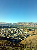
 Góry Kuh-e Chabir | |
| Państwo | |
|---|---|
| Siedziba | Ilam |
| Powierzchnia | 20 133 km²[1] |
| Populacja (2011) • liczba ludności |
|
| • gęstość | 28 os./km² |
| Plan Ilamu | |
 | |
Położenie na mapie Iranu | |
Ilam – ostan w zachodnim Iranie, w górach Zagros, przy granicy z Irakiem. Stolicą jest Ilam.
Geografia
Ostan Ilam położony jest w zachodnim Iranie w obrębie czwartego regionu administracyjnego[2]. Od północy graniczy z Kermanszahem, od wschodu z Lorestanem, od południowego wschodu z Chuzestanem, a od południowego zachodu i zachodu z Irakiem[3]. Zajmuje powierzchnię 20 133 km²[1].
Klimat ostanu jest zróżnicowany. Tereny zachodnich i południowo-zachodnich nizin położone są na wysokości 300 m n.p.m. i pokrywa sucha pustynia, a klimat jest dość ciepły. Środkowa część ostanu, w tym góry Kuh-e Dinar cechuje różnorodny klimat o zimach z temperaturami poniżej zera. Północ i północny wschód Ilamu charakteryzują roczne opady sięgające 500 mm w porównaniu do 250 mm w rejonie zachodnim i południowo-zachodnim[4].
Do większych miejscowości położonych na terenie tego ostanu należą: stołeczny Ilam, Darre Szahr, Dehloran, Abdanan, Dżafarabad, Mehran, Mejme, Ejwan, Sarable, Delgosza i Murmuri[3].
Demografia
Według spisu ludności z 2006 roku ostan Ilam zamieszkiwało 545 787 osób. Spis ludności z 2011 roku podaje 557 599 mieszkańców, co stanowi 0,74% populacji Iranu. Wśród tych osób 282 468 stanowili mężczyźni, a 275 131 kobiety. 72,9% stanowiła ludność w wieku 15–64 lat, 22,4% w wieku do lat 14, a 4,7% w wieku lat 65 i starsi[1].
Przypisy
- ↑ a b c Statistical Center of Iran: National Population and Housing Census 2011 (1390): Selected Findings (ang.). The President’s Office Deputy of Strategic Planning and Control. [dostęp 2014-10-23].
- ↑ همشهری آنلاین-استانهای کشور به ۵ منطقه تقسیم شدند (Provinces were divided into 5 regions). „Hamshahri Online”, 22-06-2014 (1 Tir 1393, Jalaali). ISSN 1735-6393 (pers.). [zarchiwizowane z adresu 23-06-2014].
- ↑ a b Ilam Province. W: Google Maps [on-line]. [dostęp 2014-10-23].
- ↑ Lorestan. ISTA Inc.. [dostęp 2014-10-23]. [zarchiwizowane z tego adresu (11-04-2014)].
Media użyte na tej stronie
Autor: Original work by Uwe Dering. Highlighted by Dr. Blofeld, Licencja: CC BY-SA 3.0
Locator map of Iran
Autor: User:Milad2017, Licencja: CC BY-SA 3.0
The map shows counties of the Ilam province, Iran.
Autor: Milad2017, Licencja: CC BY-SA 3.0
Darreh Shahr is a city in Ilam Province, Iran.
Autor: User:Milad2017, Licencja: CC BY-SA 3.0
A panoramic view of Kabir Kuh, Darreh Shahr, Iran.
State emblem of the Islamic Republic of Iran. U+262B, stylized version of Arabic script of Allah (الله, with the central lam shaped to look like a sword.) The emblem is also an overlaid rendering of La Ilaha Illa Allah (There is only one God and that is 'Allah'). The exact shape of the emblem and an algorithmic ruler-and-compass construction is described in the national Iranian standard at IRANIAN ISLAMIC REPUBLIC FLAG, ISIRI 1, 1371, 3rd edition, March 1993 in Persian. The emblem was designed by Hamid Nadimi, and was officially approved by Ayatollah Khomeini on May 9, 1980.


