Iliria
Iliria (łac. Illyria, Illyricum) – starożytna kraina nad Morzem Adriatyckim, obejmująca mniej więcej tereny obecnej Chorwacji, Bośni i Hercegowiny, Czarnogóry, Serbii, Albanii i Macedonii Północnej. Appian umiejscawia ludy Ilirii powyżej Macedonii i Tracji, aż po Dunaj, Morze Jońskie i podnóże Alp. Kraj swoją nazwę wziął od Iliriusza, syna Polifema[1].
Kolonizowana przez Greków w VII i VI wieku p.n.e. Niezależne królestwo powstało w 380 p.n.e., natomiast w 168 p.n.e. zostało ono podbite przez Rzymian i stało się rzymską prowincją Illyricum. Według rzymskich pomiarów kraj ten miał 6000 stadiów długości i około 1200 stadiów szerokości.
Przypisy
- ↑ Appian, Wojny iliryjskie 1.1 - 2.3
Zobacz też
- Ilirowie
- Królestwo Ilirii
- Królowie Ilirii
- Prefektura Ilirii (IV wiek n.e.)
- Diecezja Ilirii (IV wiek n.e.)
- Iliryzm (XIX wiek)
Media użyte na tej stronie
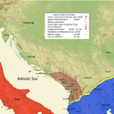
Kingdom of Agron of the Ardiaei and neighboring kingdoms.
- A History of Macedonia: 336-167 B.C By Nicholas Geoffrey Lempriere Hammond, Frank William Walbank,1988,ISBN -0198148151
- Epire, Illyrie, Macedoine: melanges offerts au professeur Pierre Cabanes by Daniele Berranger,Pierre Cabanes,Daniele Berranger-Auserve
- The Illyrians by J. J. Wilkes,1992,ISBN 0631198075,
- Epirus, 4000 years of Greek history and civilization by M. B. Hatzopoulos
- http://sitemaker.umich.edu/mladjov/files/diadokhoi240nbc.jpg
- http://sitemaker.umich.edu/mladjov/files/diadokhoi250nbc.jpg
- Blank map,File:Yugoslavia_topographic_base_map.svg
Roman principality (Client State) in Illyria governed by Demetrios of Pharos, as a Client King.
- A History of Macedonia: 336-167 B.C By Nicholas Geoffrey Lempriere Hammond, Frank William Walbank,1988,ISBN -0198148151
- Epire, Illyrie, Macedoine: melanges offerts au professeur Pierre Cabanes by Daniele Berranger,Pierre Cabanes,Daniele Berranger-Auserve
- The Illyrians by J. J. Wilkes,1992,ISBN 0631198075,
- Epirus, 4000 years of Greek history and civilization by M. B. Hatzopoulos
- Blank map,File:Yugoslavia_topographic_base_map.svg
Autor:
- Image:REmpire-05 Aquitania.png: Panairjdde
- Derivative version: Yug
Roman empire
Autor: User:Megistias, Licencja: CC-BY-SA-3.0
map of "Etnogenesis of the illyrians"
Kingdom of Illyria (under king Agron and queen Teuta, stretching "from Epirus to Neretva") and Kingdom of Dardania in the 3rd century BC. Note: borders of Illyria and Dardania are made according to the map from the article written by Fanula Papazoglu, professor of the University of Belgrade and academician of the Serbian Academy of Sciences and Arts.
Autor: MaryroseB54, Licencja: CC BY-SA 4.0
Illyrian tribes prior to Roman conquest (168 BC), map in the English language
- carte des tribus illyriennes
- illyrische Stamme Karte
- Mappa di tribu illiriche
- mapa de tribos ilirias
- Mapa Ilirske plemena
- mapa de las tribus de Illyrian
- Fiset ilire harte
- Χάρτης Ιλλυριών φυλών
- Карта из иллирийских племен
- Мапа илирског племена
Autor: MaryroseB54, Licencja: CC BY-SA 4.0
Illyrii Proprie Dicti aka Illyrians Proper aka Docleatae (Map of the Illyrii Proprie Dicti and Illyria(ns) proper, prior to their remains forming the Docleatae in the 1st century AD.
- carte des tribus illyriennes
- illyrische Stamme Karte
- Mappa di tribu illiriche
- mapa de tribos ilirias
- Mapa Ilirske plemena
- mapa de las tribus de Illyrian
- Fiset ilire harte
- Χάρτης Ιλλυριών φυλών
- Карта из иллирийских племен
- Мапа илирског племена)
Kingdom of Teuta of the Ardiaei and neighboring kingdoms.
- A History of Macedonia: 336-167 B.C By Nicholas Geoffrey Lempriere Hammond, Frank William Walbank,1988,ISBN -0198148151
- Epire, Illyrie, Macedoine: melanges offerts au professeur Pierre Cabanes by Daniele Berranger,Pierre Cabanes,Daniele Berranger-Auserve
- The Illyrians by J. J. Wilkes,1992,ISBN 0631198075,
- Epirus, 4000 years of Greek history and civilization by M. B. Hatzopoulos
- Blank map,File:Yugoslavia_topographic_base_map.svg


