Im Hinteren Eis
| ||
 | ||
| Państwo | ||
| Położenie | Sölden, Schnals | |
| Pasmo | Alpy Ötztalskie | |
| Wysokość | 3270 m n.p.m. | |
Im Hinteren Eis (wł Punta della Vedretta) – szczyt w Alpach Ötztalskich, części Centralnych Alp Wschodnich. Leży na granicy między Austrią (Tyrol) a Włochami (Południowy Tyrol). Od południa szczyt przykrywa lodowiec Hintereisferner.
Szczyt można zdobyć drogą ze schroniska Rifugio Bella Vista (2842 m).
Bibliografia
- Walter Klier: Alpenvereinsführer Ötztaler Alpen, Bergverlag Rudolf Rother, München 2006. ISBN 3-7633-1123-8
Media użyte na tej stronie
Black up-pointing triangle ▲, U+25B2 from Unicode-Block Geometric Shapes (25A0–25FF)
Autor: Rosso Robot, Licencja: CC BY-SA 3.0
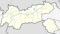
Location map of The Tyrol
Equirectangular projection. Geographic limits of the map:
- N: 47.75317° N
- S: 46.64119° N
- W: 10.08236° E
- E: 12.98961° E
Autor: Uwe Dedering, Licencja: CC BY-SA 3.0
Location map of Austria
Equirectangular projection, N/S stretching 150 %. Geographic limits of the map:
- N: 49.2° N
- S: 46.3° N
- W: 9.4° E
- E: 17.2° E
Autor: Uli.ch, Licencja: CC BY-SA 3.0
Blick auf Im hinteren Eis vom Anstieg auf den Grawand. Links in der Bildmitte die Schöne-Aussicht-Hütte.


