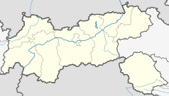
Innsbruck Hauptbahnhof
| ||
 | ||
| Państwo | ||
| Miejscowość | Innsbruck | |
| Dane techniczne | ||
| Liczba peronów | 5 | |
| Liczba krawędzi peronowych | 9 | |
| Kasy | czynne | |
| Linie kolejowe | ||
| Portal | ||
Innsbruck Hauptbahnhof – główny dworzec kolejowy w Innsbrucku, położony na wschód od centrum miasta. Obsługuje około 25 tys. pasażerów dziennie.
Media użyte na tej stronie
Autor: Lencer, Licencja: CC BY-SA 3.0
Location map of Austria
Equirectangular projection, N/S stretching 150 %. Geographic limits of the map:
- N: 49.2° N
- S: 46.3° N
- W: 9.4° E
- E: 17.2° E
Autor: Rosso Robot, Licencja: CC BY-SA 3.0
Location map of The Tyrol
Equirectangular projection. Geographic limits of the map:
- N: 47.75317° N
- S: 46.64119° N
- W: 10.08236° E
- E: 12.98961° E
Autor: Siegele Roland, Licencja: CC BY 3.0 at
Trackage of Innsbruck Hbf (main station), Austria, west side


