Instytut Polski w Tokio
 Instytut mieści się w budynku Ambasady RP | |
| Państwo | |
|---|---|
| Data utworzenia | 17 listopada 2011 |
| Siedziba | |
| Dyrektorka | Urszula Osmycka |
| Adres | |
| 2-13-5 Mita, Meguro-ku 153-0062 Tokio | |
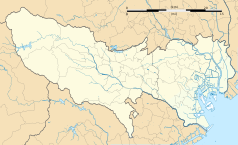
Położenie na mapie prefektury Tokio | |
| Strona internetowa | |
Instytut Polski w Tokio (jap. ポーランド広報文化センター Pōrando Kōhō Bunka Sentā) – polska placówka kulturalna w stolicy Japonii podlegająca Ministerstwu Spraw Zagranicznych RP[1].
Instytut został założony 17 listopada 2011. Głównym jego zadaniem jest wypełnianie zadań z zakresu dyplomacji publicznej, tj. utrzymywanie dobrych stosunków społecznych, naukowych i kulturalnych między Polską a Japonią. Instytut organizuje wystawy, koncerty, pokazy filmów, promocje książek, przekłady książek, koordynuje wymianę naukową i kulturową. Celem Instytutu jest poszerzanie wiedzy na temat Polski: kultury, sztuki, nauki, historii, gospodarki, polityki, socjologii[2].
Dyrektorzy
- 2011–2014 – Mirosław Łuczko[3]
- 2014–2018 – Mirosław Błaszczak[4]
- 2018–2021 – Maria Żurawska[5]
- od 1 września 2021 – Urszula Osmycka
Zobacz też
Przypisy
- ↑ Obwieszczenie Ministra Spraw Zagranicznych z dnia 3 lipca 2018 r. w sprawie wykazu jednostek organizacyjnych podległych Ministrowi Spraw Zagranicznych lub przez niego nadzorowanych, isap.sejm.gov.pl, 3 lipca 2018, s. 13 [dostęp 2020-01-24] [zarchiwizowane z adresu 2020-10-27].
- ↑ Instytut Polski w Tokio | INSTYTUT POLSKI W TOKIO [dostęp 2020-01-24] [zarchiwizowane z adresu 2019-10-13].
- ↑ Pracownicy, instytut-polski.org [dostęp 2020-01-24] [zarchiwizowane z adresu 2012-06-25].
- ↑ Krzysztof Szendzielorz, Ślązak szefem w Instytutu Polskiego w Tokio! To Mirosław Błaszczak z Tarnogórskiego Centrum Kultury, Dziennik Zachodni, 4 listopada 2013 [dostęp 2020-01-24] [zarchiwizowane z adresu 2020-01-24].
- ↑ Pracownicy, instytut-polski.org [dostęp 2020-01-24] [zarchiwizowane z adresu 2018-06-20].
Bibliografia
- Strona Instytutu
- Archiwalna strona Instytutu. instytut-polski.org. [zarchiwizowane z tego adresu (2018-06-13)].
Media użyte na tej stronie
(c) Bourrichon (atelier graphique), CC BY-SA 2.0 fr
Blank map of the prefecture of en:Tokyo, for geolocalisation purpose.
Autor: Maximilian Dörrbecker (Chumwa), Licencja: CC BY-SA 3.0
Location map of Japan
Equirectangular projection.
Geographic limits to locate objects in the main map with the main islands:
- N: 45°51'37" N (45.86°N)
- S: 30°01'13" N (30.02°N)
- W: 128°14'24" E (128.24°E)
- E: 149°16'13" E (149.27°E)
Geographic limits to locate objects in the side map with the Ryukyu Islands:
- N: 39°32'25" N (39.54°N)
- S: 23°42'36" N (23.71°N)
- W: 110°25'49" E (110.43°E)
- E: 131°26'25" E (131.44°E)
Autor: Pedro A. Gracia Fajardo, escudo de Manual de Imagen Institucional de la Administración General del Estado, Licencja: CC0
Flaga Hiszpanii
The Flag of India. The colours are saffron, white and green. The navy blue wheel in the center of the flag has a diameter approximately the width of the white band and is called Ashoka's Dharma Chakra, with 24 spokes (after Ashoka, the Great). Each spoke depicts one hour of the day, portraying the prevalence of righteousness all 24 hours of it.
The flag of Navassa Island is simply the United States flag. It does not have a "local" flag or "unofficial" flag; it is an uninhabited island. The version with a profile view was based on Flags of the World and as a fictional design has no status warranting a place on any Wiki. It was made up by a random person with no connection to the island, it has never flown on the island, and it has never received any sort of recognition or validation by any authority. The person quoted on that page has no authority to bestow a flag, "unofficial" or otherwise, on the island.
Flag of Israel. Shows a Magen David (“Shield of David”) between two stripes. The Shield of David is a traditional Jewish symbol. The stripes symbolize a Jewish prayer shawl (tallit).
Logo of the Polish Institute
Logo of the Polish Institute
Autor: Syced, Licencja: CC0
Instytut Polski w Tokio. Znajduje się w Mita w dzielnicy Meguro-ku.


