Issy-les-Moulineaux
| miejscowość i gmina | |||
 | |||
| |||
| Państwo | |||
|---|---|---|---|
| Region | |||
| Departament | |||
| Okręg | |||
| Kod INSEE | 92040 | ||
| Powierzchnia | 4,25 km² | ||
| Populacja (2012) • liczba ludności |
| ||
| • gęstość | 15 370 os./km² | ||
| Kod pocztowy | 92130 | ||
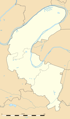
Położenie na mapie Hauts-de-Seine (c) Eric Gaba, Wikimedia Commons user Sting, CC BY-SA 3.0 | |||
Położenie na mapie Île-de-France (c) Eric Gaba, Wikimedia Commons user Sting, CC BY-SA 3.0 | |||
| Portal | |||
Issy-les-Moulineaux – miejscowość i gmina we Francji, w regionie Île-de-France, w departamencie Hauts-de-Seine. Przez miejscowość przepływa Sekwana[1].
Miasto jest stolicą dwóch kantonów:
- Issy-les-Moulineaux-Est
- Issy-les-Moulineaux-Ouest.
Według danych na rok 2012 gminę zamieszkiwało 65 322 osób, a gęstość zaludnienia wynosiła 15 370 osób/km². Wśród 1287 gmin regionu Île-de-France Issy-les-Moulineaux plasuje się na 734. miejscu pod względem powierzchni.
W miejscowości znajduje się główna siedziba telewizji Eurosport oraz France24. W przeszłości znajdowały się tu zakłady zbrojeniowe Ateliers de construction d'Issy-les-Moulineaux.
Od 1996 r. polskie Seminarium w Paryżu mieści się w Issy-les-Moulineaux[2].
Zobacz też
Linki zewnętrzne
Przypisy
- ↑ Fiche cours d'eau / La Seine (----0010). SANDRE. [dostęp 2016-04-25]. (fr.).
- ↑ Orange, sempol.paris.pagesperso-orange.fr [dostęp 2017-11-24].
Bibliografia
- Francuski urząd statystyczny. (fr.).
Media użyte na tej stronie
Autor: Superbenjamin, Licencja: CC BY-SA 4.0
Blank administrative map of France for geo-location purpose, with regions and departements distinguished. Approximate scale : 1:3,000,000
Autor: Patricia.fidi, Licencja: CC0
Unofficial (de facto) flag of the region Île-de-France in France. It was also the flag of the kingdom of France (s.XIV-XV)
(c) Eric Gaba, Wikimedia Commons user Sting, CC BY-SA 3.0
Blank administrative map of the region of Île-de-France, France, as in January 2015, for geo-location purpose, with distinct boundaries for regions, departments and arrondissements.
Map of Paris and its inner ring départements, localization of Issy-les-Moulineaux (Author: Metropolitan).
(c) Eric Gaba, Wikimedia Commons user Sting, CC BY-SA 3.0
Blank administrative map of the department of the Hauts-de-Seine, France, as in January 2015, for geo-location purpose, with distinct boundaries for departments and arrondissements.
Autor: User Francois160 on fr.wikipedia, Licencja: CC BY 1.0
Vue panoramique d'Issy-les-Moulineaux.
Autor:
|
Map data (c) OpenStreetMap contributors, CC-BY-SA • Shape files infrastructure: railway, highways, water: all originally by OpenStreetMap contributors. Status december 2011 *note: shown commune boundaries are from OSM dump May 2012; at that time about 90% complete |
Map of French municipality Issy-les-Moulineaux


