Ivindo
| Ten artykuł od 2022-07 wymaga zweryfikowania podanych informacji. |
 | |
| Kontynent | |
|---|---|
| Państwo | |
| Rzeka | |
| Długość | 500 km |
| Źródło | |
| Współrzędne | |
| Ujście | |
| Recypient | |
| Miejsce | Ogowe |
| Współrzędne | |
Ivindo – rzeka w Gabonie, najważniejszy dopływ Ogowe. Przepływa przez Park Narodowy Ivindo.
Media użyte na tej stronie
Gabon relief location map.jpg
Autor: Uwe Dedering, Licencja: CC BY-SA 3.0
Relief location map of Gabon.
Autor: Uwe Dedering, Licencja: CC BY-SA 3.0
Relief location map of Gabon.
- Projection: Equirectangular projection, strechted by 100.0%.
- Geographic limits of the map:
- N: 2.5° N
- S: -4.0° N
- W: 8.0° E
- E: 15.0° E
- GMT projection: -JX20.32cd/18.86857142857143cd
- GMT region: -R8.0/-4.0/15.0/2.5r
- GMT region for grdcut: -R8.0/-4.0/15.0/2.5r
- Relief: SRTM30plus.
- Made with Natural Earth. Free vector and raster map data @ naturalearthdata.com.
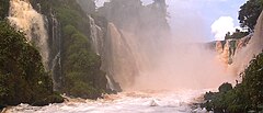
DIGITAL CROSSING - KONGOU 03.jpg
Autor: Lengai101, Licencja: CC BY-SA 3.0
View of Kongou Falls from the central part of the falls. The chinese are to build a dam that will destroy the falls.
Autor: Lengai101, Licencja: CC BY-SA 3.0
View of Kongou Falls from the central part of the falls. The chinese are to build a dam that will destroy the falls.


