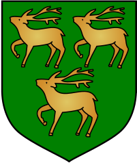
Jesus College w Oksfordzie
| ||
| University of Oxford | ||
 Herb Kolegium | ||
| Data założenia | 27 czerwca 1571 | |
| Patron | Jezus Chrystus | |
| Państwo | ||
| Kraj | ||
| Adres | Oksford | |
| Liczba studentów | 475 | |
| Dyrektor | lord Krebs | |
| Członkostwo | University of Oxford | |
Położenie na mapie Oksfordu Contains Ordnance Survey data © Crown copyright and database right, CC BY-SA 3.0 | ||
Położenie na mapie Oxfordshire Contains Ordnance Survey data © Crown copyright and database right, CC BY-SA 3.0 | ||
| Strona internetowa | ||
Jesus College (Kolegium Jezusowe, pełna nazwa: Jesus College in the University of Oxford of Queen Elizabeth's Foundation, Kolegium Jezusowe na Uniwersytecie Oksfordzkim, Fundacji Królowej Elżbiety) – jedno z kolegiów wchodzących w skład University of Oxford. Zostało założone 27 czerwca 1571 roku przez królową Elżbietę I, a głównym inicjatorem jego powstania był walijski duchowny i prawnik Hugh Price, znany także jako ap Rhys. Pierwotnym celem istnienia kolegium miało być przede wszystkim kształcenie anglikańskich księży, choć z czasem otworzyło się również na studentów i badaczy świeckich. Aż do drugiej połowy XIX wieku większość profesorów i studentów kolegium stanowili Walijczycy. Kobiety mogą do niego należeć od 1974 roku.
Obecnie kolegium skupia ok. 475 studentów, z czego ok. 325 osób stanowią słuchacze studiów licencjackich, a ok. 150 osób to magistranci i doktoranci. Od 2005 roku dyrektorem Jesus College jest John Krebs (lord Krebs), jeden z czołowych brytyjskich ornitologów. Siostrzanym kolegium na Uniwersytecie Cambridge jest tamtejsze Jesus College. Wśród znanych absolwentów kolegium byli m.in. dwukrotny premier Wielkiej Brytanii Harold Wilson, były premier Jamajki Norman Manley oraz archeolog i podróżnik Thomas Edward Lawrence (znany szerzej jako Lawrence z Arabii).
Galeria
Bibliografia
| ||||
Media użyte na tej stronie
Autor: NordNordWest, Licencja: CC BY-SA 3.0
Location map of the United Kingdom
Flag of England. Saint George's cross (a red cross on a white background), used as the Flag of England, the Italian city of Genoa and various other places.
Autor: Bencherlite, Licencja: CC BY-SA 3.0
The Principal's Lodgings (left) and chapel (right) of Jesus College.
Coat of Arms of Oxford University
I took this last August. Use it if you like.
Contains Ordnance Survey data © Crown copyright and database right, CC BY-SA 3.0
Map of Oxford, Oxfordshire, UK with electoral wards shown.
Equirectangular map projection on WGS 84 datum, with N/S stretched 160%
Geographic limits:
- West: 1.32W
- East: 1.17W
- North: 51.81N
- South: 51.69N
Autor: Andrew Rivett from Toronto, Canada, Licencja: CC BY 2.0
A view across the front quad of Jesus College, Oxford from the entrance; the hall is to the right of the passageway on the far side.
Autor: John Ward from England, Licencja: CC BY 2.0
The second quadrangle of Jesus College, Oxford. The Dutch gables have ogee sides and semi-circular pediments. The writer Simon Jenkins said that the quadrangle has "the familiar Oxford Tudor windows and decorative Dutch gables, crowding the skyline like Welsh dragons' teeth..."[1]
Contains Ordnance Survey data © Crown copyright and database right, CC BY-SA 3.0
Map of Oxfordshire, UK with the following information shown:
- Administrative borders
- Coastline, lakes and rivers
- Roads and railways
- Urban areas
Equirectangular map projection on WGS 84 datum, with N/S stretched 160%
Geographic limits:
- West: 1.74W
- East: 0.72W
- North: 52.19N
- South: 51.44N


