Jingpo Lacus
| ||
 Mozaika map radarowych Jingpo Lacus w fałszywych barwach, stan wiedzy na 2013 rok. | ||
| Położenie | ||
| Państwo | nie dotyczy terytorium pozaziemskie | |
| Region | Tytan | |
| Morfometria | ||
| Wymiary • max długość • max szerokość | 240 km ok. 70 km | |
| Hydrologia | ||
| Rodzaj jeziora | jezioro węglowodorów | |
Jingpo Lacus – czwarte co do wielkości jezioro na Tytanie, największym księżycu Saturna. Wypełniają je płynne węglowodory. Zostało odkryte na zdjęciach radarowych okolic północnego bieguna Tytana przez sondę Cassini; znajduje się w pobliżu Kraken Mare, największego zbiornika węglowodorów na Tytanie. Jego nazwa pochodzi od ziemskiego jeziora Jingpo Hu położonego w Chinach[1]. Jest ono niemal tych samych rozmiarów co Ontario Lacus, największe jezioro południowej półkuli tego księżyca, ale ma bardziej złożoną linię brzegową i przypuszczalnie dużo większą głębokość[2].
W 2009 roku zarejestrowano odbicia światła słonecznego (w zakresie podczerwieni) od tafli tego jeziora i Kraken Mare[2]. Obserwacje te stanowiły kluczowe dowody potwierdzające występowanie cieczy na powierzchni Tytana[3], ponadto pozwoliły nałożyć ograniczenie na nierówność powierzchni jezior: najprawdopodobniej w chwili rejestracji Jingpo Lacus było zupełnie pozbawione fal[2].
Zobacz też
Przypisy
- ↑ Jingpo Lacus Gazetteer of Planetary Nomenclature, USGS Astrogeology Research Program
- ↑ a b c Jason W. Barnes, Jason M. Soderblom, Robert H. Brown, Laurence A. Soderblom i inni. Wave constraints for Titan’s Jingpo Lacus and Kraken Mare from VIMS specular reflection lightcurves. „Icarus”. 211, s. 722-731, 2011. DOI: 10.1016/j.icarus.2010.09.022.
- ↑ Sunlight Glint Confirms Liquid in Titan Lake Zone (ang.). NASA, 2009-12-17. [dostęp 2014-02-02].
Media użyte na tej stronie
Autor: Tzugaj, Licencja: CC0
znak graficzny do map, ukazujący przykładowe jezioro
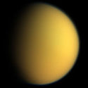
This natural color composite was taken during the Cassini spacecraft's April 16, 2005, flyby of Titan. It is a combination of images taken through three filters that are sensitive to red, green and violet light. It shows approximately what Titan would look like to the human eye: a hazy orange globe surrounded by a tenuous, bluish haze. The orange color is due to the hydrocarbon particles which make up Titan's atmospheric haze. This obscuring haze was particularly frustrating for planetary scientists following the NASA Voyager mission encounters in 1980-81. Fortunately, Cassini is able to pierce Titan's veil at infrared wavelengths (see PIA06228). North on Titan is up and tilted 30 degrees to the right. The images to create this composite were taken with the Cassini spacecraft wide angle camera on April 16, 2005, at distances ranging from approximately 173,000 to 168,200 kilometers (107,500 to 104,500 miles) from Titan and from a Sun-Titan-spacecraft, or phase, angle of 56 degrees. Resolution in the images is approximately 10 kilometers per pixel. The Cassini-Huygens mission is a cooperative project of NASA, the European Space Agency and the Italian Space Agency. The Jet Propulsion Laboratory, a division of the California Institute of Technology in Pasadena, manages the mission for NASA's Science Mission Directorate, Washington, D.C. The Cassini orbiter and its two onboard cameras were designed, developed and assembled at JPL. The imaging team is based at the Space Science Institute, Boulder, Colo. For more information about the Cassini-Huygens mission, visit http://saturn.jpl.nasa.gov and the Cassini imaging team home page, http://ciclops.org.
Mapa powierzchni Tytana, bez ramki i zmniejszona w celu użycia w szablonach, przede wszystkim lokalizacyjnych. Mapa przedstawia stan wiedzy z grudnia 2018 roku.
Mapa radarowa Jingpo Lacus - stan wiedzy z 2013 r. Obraz powstał przez przycięcie mozaiki PIA 17655 (zob. File:PIA17655 crop Titan north polar seas and lakes.jpg).
This image shows the first flash of sunlight reflected off a hydrocarbon lake on Saturn's moon Titan. The glint off a mirror-like surface is known as a specular reflection. This kind of glint was detected by the visual and infrared mapping spectrometer (VIMS) on NASA's Cassini spacecraft on July 8, 2009. It confirmed the presence of liquid in the moon's northern hemisphere, where lakes are more numerous and larger than those in the southern hemisphere. Scientists using VIMS had confirmed the presence of liquid in Ontario Lacus, the largest lake in the southern hemisphere, in 2008.
The northern hemisphere was shrouded in darkness for nearly 15 years, but the sun began to illuminate the area again as it approached its spring equinox in August 2009. VIMS was able to detect the glint as the viewing geometry changed. Titan's hazy atmosphere also scatters and absorbs many wavelengths of light, including most of the visible light spectrum. But the VIMS instrument enabled scientists to look for the glint in infrared wavelengths that were able to penetrate through the moon's atmosphere. This image was created using wavelengths of light in the 5 micron range.
By comparing the new image to radar and near-infrared light images acquired from 2006 to 2008, Cassini scientists were able to correlate the reflection to a lake, later named Jingpo Lacus, near the western shores of the sea known as Kraken Mare. Jingpo Lacus covers an area of 20,800 square kilometers (8,000 square miles). The reflection appeared to come from a part of the lake near 71 degrees north latitude and 337 degrees west longitude.
It was taken on Cassini's 59th flyby of Titan on July 8, 2009, at a distance of about 200,000 kilometers (120,000 miles). The image resolution was about 100 kilometers (60 miles) per pixel. Image processing was done at the German Aerospace Center in Berlin and the University of Arizona in Tucson.
The Cassini-Huygens mission is a cooperative project of NASA, the European Space Agency and the Italian Space Agency. The Jet Propulsion Laboratory, a division of the California Institute of Technology in Pasadena, manages the mission for NASA's Science Mission Directorate, Washington, D.C. The Cassini orbiter was designed, developed and assembled at JPL. The visual and infrared mapping spectrometer team is based at the University of Arizona, Tucson.
For more information about the Cassini-Huygens mission visit http://saturn.jpl.nasa.gov/home/index.cfm. The visual and infrared mapping spectrometer team homepage is at http://wwwvims.lpl.arizona.edu.


