Johnston (terytorium)
| |||||
| Status terytorium | |||||
|---|---|---|---|---|---|
| Zależne od | |||||
| Głowa terytorium | |||||
| Powierzchnia • całkowita • wody śródlądowe |
| ||||
| Waluta | dolar amerykański (USD) | ||||
| Rok utworzenia | 1858 | ||||
| Strefa czasowa | UTC -10 | ||||
| Domena internetowa | |||||
 | |||||
.svg)
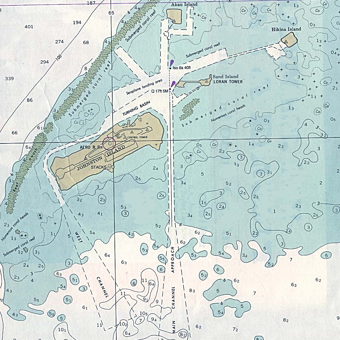
Johnston (ang. Johnston Atoll) – niezamieszkane terytorium nieinkorporowane Stanów Zjednoczonych na Pacyfiku (ok. 1400 km na zachód od Hawajów). Powierzchnia atolu wynosi 2,67 km². W skład atolu wchodzą cztery wyspy, z których największa to Johnston Island. Współrzędne geograficzne: 16°45′N 169°31′W/16,750000 -169,516667. Najwyższym punktem jest Summit Peak, wznoszący się na 5 m n.p.m. Ich klimat jest wilgotny. Żyją tu liczne gatunki ptaków morskich. W 1858 zostały one zaanektowane przez USA i ówczesne Królestwo Hawajów. Na wyspach znajdują się liczne zasoby guana, które były eksploatowane, na większą skalę, jako nawóz naturalny do końca lat 80. XIX wieku. W XX w. przez wiele lat wyspa była ważnym ogniwem amerykańskiego systemu obrony na Pacyfiku. Atolem zarządza obecnie Agencja obrony nuklearnej Stanów Zjednoczonych oraz US Fish and Wildlife Service.

Mapa fotograficzna atolu, stworzona ze zdjęcia satelitarnego

Wzrost powierzchni głównej wyspy atolu

Nieoficjalna flaga Johnston
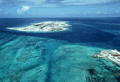
Zdjęcie lotnicze
Linki zewnętrzne
- Artykuł o atolu Johnston na stronie CIA. cia.gov. [zarchiwizowane z tego adresu (2007-05-09)].
- Dokładna mapa atolu
| Państwa | |
|---|---|
| Terytoria zależne | |
| Integralne części państw położonych poza Australią i Oceanią |
|
Media użyte na tej stronie

The flag of Navassa Island is simply the United States flag. It does not have a "local" flag or "unofficial" flag; it is an uninhabited island. The version with a profile view was based on Flags of the World and as a fictional design has no status warranting a place on any Wiki. It was made up by a random person with no connection to the island, it has never flown on the island, and it has never received any sort of recognition or validation by any authority. The person quoted on that page has no authority to bestow a flag, "unofficial" or otherwise, on the island.
.svg)
Unofficial flag of Johnston Atoll, used to represent the island in a December 7, 2001 Pearl Harbor ceremony. The official flag of Johnston Atoll is the flag of the United States (also, the Kingdom of Hawaii claimed the island in the 1850s).
.svg)
Autor: Ch1902, Licencja: CC BY-SA 3.0
Orthographic map of the Australasian part of Oceania: Australia, New Guinea, Island Melanesia, New Zealand the Maluccas east of the Weber Line.

Satellite map of Johnston Atoll (Kalama Atoll), U.S. Territory in the North Pacific Ocean.

Aerial View Johnston Island as seen from northeast, approaching runway. Western part of sand island seen on the right side

Recreated in Inkscape (and later edited manually) by me. "Growth of Johnston Island by coral dredging"