Joure
 | |||||
| Państwo | |||||
|---|---|---|---|---|---|
| Prowincja | |||||
| Populacja (2007) • liczba ludności • gęstość |
| ||||
| Nr kierunkowy | 0513 | ||||
| Kod pocztowy | 8500-8503 | ||||
| Strona internetowa | |||||
Joure (De Jouwer) – miasto w północnej Holandii, w prowincji Fryzja. Około 13 tysięcy mieszkańców.
Media użyte na tej stronie
Autor: Erik Frohne, Licencja: CC BY-SA 3.0
Location map of province Friesland in the Netherlands
Equirectangular projection, N/S stretching 164 %. Geographic limits of the map:
- N: 53.60° N
- S: 52.60° N
- W: 4.70° E
- E: 6.50° E
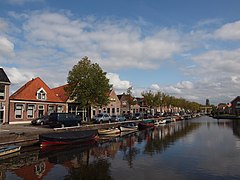
View from the east on the centre of the Dutch town of Joure (Friesland). Most prominent in this picture is Joure's newly built (2004) library (Bibliotheek) on the right.
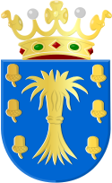
Coat of arms of Joure (Netherlands)
Autor: Fryske Rie foar Heraldyk, svg by Arch, Licencja: CC BY-SA 3.0
COA of the village of Oudeschoot (Friesland) Netherlands
Autor: Baykedevries, Licencja: CC BY-SA 3.0 nl
To jest zdjęcie holenderskiego zabytku (rijksmonument) numer 20843


