Juan-les-Pins
© Túrelio (via Wikimedia-Commons), 2006, CC BY-SA 2.5 Widok na Morze Śródziemne z Juan-les-Pins | |
| Państwo | |
|---|---|
| Region | |
| Departament | |
| Okręg | |
| Kanton | |
| Gmina | |
| Wysokość | 10 m n.p.m. |
| Kod pocztowy | 06600[1] |
| Strefa czasowa | UTC+1 |
| Strona internetowa | |
| Portal | |
Juan-les-Pins – miasto uzdrowiskowe w południowo-wschodniej części Francji w Alpach Nadmorskich.
Położenie
Juan-les-Pins znajduje się między Niceą a Cannes; nad Morzem Śródziemnym. Miasto dzieli około 13 kilometrów do portu lotniczego Corte d’Azur. Położone jest na zachód od miasta Antibes, na zachodnim zboczu pasma górskiego.
Historia
12 marca 1882 roku wieś została nazwana Juan-les-Pins. „Juan” pochodzi z języka oksytańskiego; w języku francuskim odpowiednikiem „Juan” jest „John”. W 1883, zdecydowano się na budowę dworca kolejowego w Juan-les-Pins, w linii Paryż-Lyon-Morze Śródziemne (PLM), która przechodziła już przez miasto w 1863 roku.
Turystyka
Ze względu na swoje atrakcyjne położenie przy Morzu Śródziemnym, w miejscowości jest wiele atrakcji dla turystów. Oto niektóre z nich[2]:
- Juan-les-Pins Mian Beach,
- Parc de la Pinède,
- Palais des Congrès Antibes Juan-les-Pins,
- Square Frnak Jay Gold.
Galeria
Plaża i hotele nad Morzem Śródziemnym
Miasta partnerskie
Lista miast partnerskich:
 Schwäbisch Gmünd, Niemcy
 Olimpia, Grecja
 Kinsale, Irlandia
 Desenzano del Garda, Włochy
 Aalborg, Dania
 Newport Beach, Stany Zjednoczone
 Eilat, Izrael
Zobacz też
Przypisy
- ↑ Code Postal 06600 Antibes France Profil et Carte des Limites - February 2021, worldpostalcodes.org [dostęp 2021-02-17] (fr.).
- ↑ Co warto zobaczyć w Juan-les-Pins: 10 NAJLEPSZYCH atrakcji, Tripadvisor [dostęp 2021-02-16] (pol.).
Media użyte na tej stronie
Autor: Superbenjamin, Licencja: CC BY-SA 4.0
Blank administrative map of France for geo-location purpose, with regions and departements distinguished. Approximate scale : 1:3,000,000
Autor: Flappiefh, Licencja: CC BY-SA 4.0
Blank administrative map of the region of Provence-Alpes-Côte d'Azur, France, for geo-location purpose.
The flag of Navassa Island is simply the United States flag. It does not have a "local" flag or "unofficial" flag; it is an uninhabited island. The version with a profile view was based on Flags of the World and as a fictional design has no status warranting a place on any Wiki. It was made up by a random person with no connection to the island, it has never flown on the island, and it has never received any sort of recognition or validation by any authority. The person quoted on that page has no authority to bestow a flag, "unofficial" or otherwise, on the island.
Flag of Israel. Shows a Magen David (“Shield of David”) between two stripes. The Shield of David is a traditional Jewish symbol. The stripes symbolize a Jewish prayer shawl (tallit).
Autor: Flappiefh, Licencja: CC BY-SA 4.0
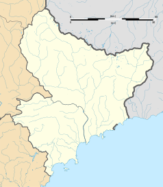
Blank administrative map of the department of Alpes-Maritimes, France, for geo-location purpose.
Autor: Txllxt TxllxT, Licencja: CC BY-SA 4.0
Juan-Les-Pins - Boulevard Édouard Baudoin - View WNW
An 'en plein air' example of late realism and genre painting.
Autor: Txllxt TxllxT, Licencja: CC BY-SA 4.0
Juan-Les-Pins - Boulevard Édouard Baudoin - View West
© Túrelio (via Wikimedia-Commons), 2006, CC BY-SA 2.5
Sunset view on the Mediterranean Sea towards Cannes from Juan-Les-Pins near Nice, France


