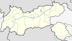
Jungholz
 | |||
| |||
| Państwo | |||
|---|---|---|---|
| Kraj związkowy | |||
| Powiat | |||
| Burmistrz | Karina Konrad | ||
| Powierzchnia | 7,06 km² | ||
| Wysokość | 1054 m n.p.m. | ||
| Populacja (1 stycznia 2015) • liczba ludności |
| ||
| • gęstość | 40,08 os./km² | ||
| Numer kierunkowy | 05676 | ||
| Kod pocztowy | 6691 (Austria) | ||
| Tablice rejestracyjne | RE | ||
| Strona internetowa | |||
Jungholz – gmina w Austrii, w kraju związkowym Tyrol, w powiecie Reutte. Do miejscowości można dostać się tylko z terytorium Niemiec, dlatego jest tyrolską eksklawą. Przez miejscowych nazywana jest jako „kawałek Tyrolu w Allgäu”.
Burmistrzem jest Karina Konrad[1], która pełni tę funkcję od 2016 roku[2].
Położenie
Teren gminy wkoło otoczony jest niemieckim krajem związkowym Bawaria. Jungholz sąsiaduje z resztą Austrii w jednym punkcie, którym jest szczyt góry Sorgschrofen[3].
Miejscowość znajduje się w niemieckim obszarze celnym[4] i posiada dwa kody pocztowe: austriacki (6691)[5] oraz niemiecki (87491)[6][7].
Demografia
1 stycznia 2015 w gminie mieszkały 283 osoby[8], w 2012 308 osób[9], a w 2014 288 osób[10].
Zmiany liczby ludności w miejscowości Jungholz od 1869 roku[11].
Źródło: Statistik Österreich
Przypisy
- ↑ [https://wahlen.tirol.gv.at/gemeinderats_und_buergermeisterwahlen_2016/gemeinden/jungholz.html Gemeinderats- und Bürgermeisterwahlen 2016 Gemeinde Jungholz] (niem.). tirol.gv.at. [dostęp 2017-02-13].
- ↑ Karina Konrad (Bürgermeisterin) (niem.). jungholz.tirol.gv.at. [dostęp 2017-02-13].
- ↑ The boundary cross at Jungholz (ang.). enclaves.org. [dostęp 2015-05-10].
- ↑ ROZPORZĄDZENIE RADY (EWG) NR 2913/92 z dnia 12 października 1992 r. ustanawiające Wspólnotowy Kodeks Celny (pol.). europa.eu, 1992-10-19. s. 2. [dostęp 2015-05-10].
- ↑ PLZ Verzeichnis Februar 2017 (niem.). post.at. [dostęp 2017-02-13]. [zarchiwizowane z tego adresu (2017-02-13)].
- ↑ Postleitzahlen – Jungholz (niem.). postdirekt.de. [dostęp 2015-05-10].
- ↑ Jungholz (niem.). postleitzahlenindex.de. [dostęp 2015-05-10].
- ↑ Einwohnerzahl nach Gemeinden mit Status 1.1.2015 (niem.). statistik.at. s. 37. [dostęp 2015-08-01].
- ↑ Bevölkerungsstand 1-1-2012. Wien: Statistik Austria, 2012, s. 152. ISBN 978-3-902791-47-4. (niem.)
- ↑ Einwohnerzahl nach Gemeinden mit Status 1.1.2014 (niem.). statistik.at, 2014. s. 47. [dostęp 2015-05-10].
- ↑ Gemeinde Jungholz – Bevölkerungsentwicklung 1869-2016 (niem.). statistik.at. [dostęp 2016-10-15].
Media użyte na tej stronie
Autor: Rosso Robot, Licencja: CC BY-SA 3.0
Location map of The Tyrol
Equirectangular projection. Geographic limits of the map:
- N: 47.75317° N
- S: 46.64119° N
- W: 10.08236° E
- E: 12.98961° E
Autor: Lencer, Licencja: CC BY-SA 3.0
Location map of Austria
Equirectangular projection, N/S stretching 150 %. Geographic limits of the map:
- N: 49.2° N
- S: 46.3° N
- W: 9.4° E
- E: 17.2° E
View from southside of Pfeiferberg to the west on Jungholz (1058 m). In the background Nebelhorn-Northridge, Entschenkopf (2043 m), Jochschrofen (1625 m), Spieser (1651 m), Wertacher Hörnle (1695 m), Starzlachberg (1585 m) and Gerenköpfle (1504 m).
Blazon:„Argent, a left eagle wing gules, charged with a trifoil Or, ahead out of the wing, a seven-leaved branch issuant vert.“
The arms were officially granted on February 28, 1978. The eagle wing is taken from the arms of Tyrol and thus indicates that the area has been part of Tyrol for many centuries. The young sprig is canting (Jungholz means "young wood").


