Königsfeld (Bawaria)
| gmina | |||
 | |||
| |||
| Państwo | |||
|---|---|---|---|
| Kraj związkowy | |||
| Rejencja | Górna Frankonia | ||
| Powiat | Bamberg | ||
| Kod statystyczny | 09 4 71 151 | ||
| Powierzchnia | 42,72 km² | ||
| Wysokość | 460 m n.p.m. | ||
| Populacja (31 grudnia 2011) • liczba ludności | 1 338 | ||
| • gęstość | 31 os./km² | ||
| Numer kierunkowy | 09207 | ||
| Kod pocztowy | 96167 | ||
| Tablice rejestracyjne | BA | ||
Adres urzędu: Hauptstraße 2196167 Königsfeld | |||
Położenie na mapie powiatu | |||
| 49°57′N 11°10′E/49,950000 11,166667 | |||
| Strona internetowa | |||
| Portal | |||

Königsfeld – miejscowość i gmina w Niemczech, w kraju związkowym Bawaria, w rejencji Górna Frankonia, w regionie Oberfranken-West, w powiecie Bamberg, wchodzi w skład wspólnoty administracyjnej Steinfeld. Leży w Szwajcarii Frankońskiej, około 20 km na północny wschód od Bamberga, nad rzeką Aufseß, przy drodze B22.
Dzielnice
W skład gminy wchodzą następujące dzielnice:
 |  | Huppendorf | 143 |
 |  | Königsfeld | 569 |
 | _Ortsmitte_4.jpg) | Kotzendorf | 107 |
 | Laibarös | 148 | |
 | Poxdorf | 159 | |
 |  | Treunitz | 160 |
 |  | Voitmannsdorf | 125 |
Położenie
Königsfeld graniczy z następującymi gminami:
- Litzendorf (na zachodzie)
- Scheßlitz (na północnym zachodzie)
- Stadelhofen (na północy)
- Hollfeld (na wschodzie)
- Heiligenstadt in Oberfranken (na południu)
Zabytki i atrakcje
- Kościół pw. św. Jakuba i Katarzyny (St. Jakobus und Katharina)
- Kaplica św. Anny (St. Anna)
- kaplica w dzielnicy Laibarös
- źródło rzeki Aufseß
Galeria

Kościół św. Jakuba i Katarzyny (St, Jakobus und Katharina)
Źródło Aufseß

Panorama Königsfelda

- Siedziba powiatu: Bamberg
| Miasta | |
|---|---|
| Gminy targowe | |
| Gminy | |
| Obszary wolne administracyjnie | |
| Wspólnoty administracyjne |

Media użyte na tej stronie

.svg)
|
|
|
|
|
|
|
|

Autor: Immanuel Giel, Licencja: CC-BY-SA-3.0
chapel of the village Treunitz near Hollfeld / Bamberg (Franconia)
the village Laibarös in the German district of Bamberg
the village Poxdorf in the German district of Bamberg
the village Voitmannsdorf in the German district of Bamberg
the village Kotzendorf in the German district of Bamberg
village in Germany
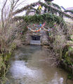
Kotzendorf an der Aufseß, part of Königsfeld in Oberfranken, Germany
the village Huppendorf in the German district of Bamberg

the village Treunitz in the German district of Bamberg
the village Königsfeld in the German district of Bamberg
