Kangerluarsunnguaq
 Zatoka Kangerluarsunnguaq w Sisimiut latem 2010 roku | |
| Państwo | |
|---|---|
| Terytorium zależne | |
| Miejscowości | |
| Rodzaj obiektu | zatoka |
Kangerluarsunnguaq, (duń.) Ulkebugten[1] – zatoka u zachodnich wybrzeży Grenlandii. We wschodniej części zatoka oddziela główną część Sisimiut od północnej, słabo zurbanizowanej części miasta. Na północnym wybrzeżu zatoki, u ujścia do Cieśniny Davisa, jest położony port lotniczy Sisimiut[2].
Przypisy
- ↑ 800-A28 Boligområde ved Kangerluarsunnguaq. qeqqata.odeum.com. [dostęp 2014-02-15]. [zarchiwizowane z tego adresu (2016-03-04)]. (duń.).
- ↑ Kangerluarsunnguaq Bay, Qeqqata, Grenlandia. Mapy Google. [dostęp 2014-02-15]. (pol.).
Linki zewnętrzne
- Kangerluarsunnguaq Bay. touristlink.com. [dostęp 2014-02-15]. [zarchiwizowane z tego adresu (2014-04-09)]. (ang.).
- Investigation of heavy metals and nutrients in the sediments in Ulkebugten near Sisimiut (Greenland). byg.dtu.dk (PDF). [dostęp 2014-02-15]. (ang.).
Media użyte na tej stronie
Autor: Chmee2, Licencja: CC BY 3.0
Kangerluarsunnguaq Bay near Sisimiut, Greenland
Autor: Uwe Dedering, Licencja: CC BY-SA 3.0
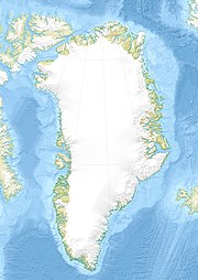
Relief location map of Greenland.
- Projection: EquiDistantConicProjection.
- Area of interest:
- N: 85.0° N
- S: 59.0° N
- W: -75.0° E
- E: -10.0° E
- Projection center:
- NS: 72.0° N
- WE: -42.5° E
- Standard parallels:
- 1: 64.0° N
- 2: 80.0° N
- GMT projection: -JD-42.5/72/64/80/20c
- GMT region: -R-60.16/57.61/24.5/79.91r
- GMT region for grdcut: -R-120.24/57.61/24.5/85.78r
- Relief: SRTM30plus.
- Made with Natural Earth. Free vector and raster map data @ naturalearthdata.com.
Autor: Algkalv (talk), Licencja: CC BY-SA 3.0
Sisimiut Airport, Greenland, photographed from under the main summit of Palasip Qaqqaa (544m).


