Kangertittivaq
 | |
| Państwo | |
|---|---|
| Terytorium zależne | |
| Wymiary | długość 350 km |
| Głębokość • maksymalna |
|
 zdjęcie satelitarne fiordu | |
Kangertittivaq (duń. Scoresby Sund) – fiord we wschodniej części Grenlandii. Jest najdłuższym (350 km) i jednym z najgłębszych (ponad 1500 m głębokości) na Ziemi.
Media użyte na tej stronie
Autor: Uwe Dedering, Licencja: CC BY-SA 3.0
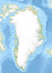
Relief location map of Greenland.
- Projection: EquiDistantConicProjection.
- Area of interest:
- N: 85.0° N
- S: 59.0° N
- W: -75.0° E
- E: -10.0° E
- Projection center:
- NS: 72.0° N
- WE: -42.5° E
- Standard parallels:
- 1: 64.0° N
- 2: 80.0° N
- GMT projection: -JD-42.5/72/64/80/20c
- GMT region: -R-60.16/57.61/24.5/79.91r
- GMT region for grdcut: -R-120.24/57.61/24.5/85.78r
- Relief: SRTM30plus.
- Made with Natural Earth. Free vector and raster map data @ naturalearthdata.com.
Satellite photo of Scoreby Sound, East coast of Greenland.
Autor: Hannes Grobe 20:20, 16 December 2010 (UTC), Licencja: CC BY-SA 2.5
Scoresby Sund, Greenland


