Kaspijsk
 Cerkiew Kazańskiej Ikony Matki Bożej | |||
| |||
| Państwo | |||
|---|---|---|---|
| Republika | |||
| Powierzchnia | 32,9[1] km² | ||
| Populacja (2020) • liczba ludności • gęstość | 123 988[2] 3764,06 os./km² | ||
| Nr kierunkowy | +7 87246 | ||
| Kod pocztowy | 368300 | ||
| Tablice rejestracyjne | 05 | ||
| Strona internetowa | |||
| Portal | |||
Kaspijsk (ros. Каспийск) – miasto w Rosji (Dagestan) nad Morzem Kaspijskim.
W mieście przeważa przemysł włókienniczy, maszynowy oraz materiałów budowlanych[3].. W Kaspijsku jest muzeum krajoznawcze. Liczba ludności to ok. 123 tys. (2020).
Przypisy
- ↑ Каспийск [dostęp 2021-05-09] (ros.).
- ↑ Численность постоянного населения Республики Дагестан по состоянию на 1 января 2020 года [dostęp 2021-05-09] (ros.).
- ↑ Kaspijsk, [w:] Encyklopedia PWN [online] [dostęp 2021-07-15].
Media użyte na tej stronie
Autor: Uwe Dedering, Licencja: CC BY-SA 3.0
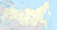
Location map of Russia.
EquiDistantConicProjection : Central parallel :
* N: 54.0° N
Central meridian :
* E: 100.0° E
Standard parallels:
* 1: 49.0° N
* 2: 59.0° N
Made with Natural Earth. Free vector and raster map data @ naturalearthdata.com.
Because the southern Kuril islands are claimed by Russia and Japan, they are shown as disputed. For more information about this see: en:Kuril Islands dispute. These islands are since 1945 under the jurisdiction of the Russian Federation.
Autor: Das steinerne Herz, Licencja: CC BY-SA 3.0
Dagestan location map
Equirectangular projection, N/S stretching 136.7 %. True scale parallel: 43°00' N. Geographic limits of the map:
- N: 45.0° N
- S: 41.17° N
- W: 45.0° E
- E: 48.67° E


