Katastrofa lotnicza w Butte
| Państwo | |
|---|---|
| Miejsce | |
| Data | |
| Godzina | 14:32 czasu lokalnego |
| Rodzaj | Zderzenie z ziemią |
| Przyczyna | Aktualnie nieznana |
| Ofiary | 14 osób |
| Ranni | 0 osób |
| Ocaleni | 0 osób |
| Statek powietrzny | |
| Typ | |
| Użytkownik | Samolot prywatny |
| Numer | N128CM |
| Start | |
| Cel lotu | |
| Pasażerowie | 12 osób |
| Załoga | 2 osoby |
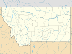
Katastrofa lotnicza w Butte – katastrofa lotnicza, która wydarzyła się 23 marca 2009 roku.
Pilatus PC-12 lecący Redlands do Bozeman z niewiadomych przyczyn rozbił się 150 metrów od pasa startowego na terenie cmentarza. Samolot odbywał lot do Bozeman, jednak na kilka minut przed lądowaniem, piloci postanowili lądować w Butte. W katastrofie zginęło 14 osób (w tym 7 dzieci lecących na narty) - wszyscy na pokładzie.
Linki zewnętrzne
- Tragedia w Montanie - Wiadomości. wiadomosci.gazeta.pl. [zarchiwizowane z tego adresu (2009-03-26)].
Media użyte na tej stronie
Autor: Uwe Dedering, Licencja: CC BY-SA 3.0
Location map of the USA (without Hawaii and Alaska).
EquiDistantConicProjection:
Central parallel:
* N: 37.0° N
Central meridian:
* E: 96.0° W
Standard parallels:
* 1: 32.0° N
* 2: 42.0° N
Made with Natural Earth. Free vector and raster map data @ naturalearthdata.com.
Formulas for x and y:
x = 50.0 + 124.03149777329222 * ((1.9694462586094064-({{{2}}}* pi / 180))
      * sin(0.6010514667026994 * ({{{3}}} + 96) * pi / 180))
y = 50.0 + 1.6155950752393982 * 124.03149777329222 * 0.02613325650382181
      - 1.6155950752393982  * 124.03149777329222 *
     (1.3236744353715044  - (1.9694462586094064-({{{2}}}* pi / 180))
      * cos(0.6010514667026994 * ({{{3}}} + 96) * pi / 180))
The flag of Navassa Island is simply the United States flag. It does not have a "local" flag or "unofficial" flag; it is an uninhabited island. The version with a profile view was based on Flags of the World and as a fictional design has no status warranting a place on any Wiki. It was made up by a random person with no connection to the island, it has never flown on the island, and it has never received any sort of recognition or validation by any authority. The person quoted on that page has no authority to bestow a flag, "unofficial" or otherwise, on the island.


