Katedra św. Jana Ewangelisty w Salford
| katedra | |||||||||||
 Katedra w Salford | |||||||||||
| Państwo | |||||||||||
|---|---|---|---|---|---|---|---|---|---|---|---|
| Kraj | |||||||||||
| Miejscowość | |||||||||||
| Wyznanie | |||||||||||
| Kościół | |||||||||||
| |||||||||||
| |||||||||||
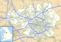
Położenie na mapie Wielkiego Manchesteru Contains Ordnance Survey data © Crown copyright and database right, CC BY-SA 3.0 | |||||||||||
Położenie na mapie Wielkiej Brytanii (c) Karte: NordNordWest, Lizenz: Creative Commons by-sa-3.0 de | |||||||||||
Katedra w Salford (ang. Cathedral Church of St. John the Evangelist) – katedra rzymskokatolicka w Salford. Główna świątynia diecezji Salford. Mieści się przy Chapel Street.
Budowa świątyni rozpoczęła się w 1844, zakończyła się w 1848; konsekrowana w 1890. Reprezentuje styl neogotycki. Projektantem świątyni był Matthew Ellison Hadfield. Posiada jedną wieżę.
Bibliografia
- Strona WWW katedry. dioceseofsalford.org.uk. [zarchiwizowane z tego adresu (2013-03-31)].
Media użyte na tej stronie
(c) Karte: NordNordWest, Lizenz: Creative Commons by-sa-3.0 de
Location map of the United Kingdom
Blue Shield - the Distinctive emblem for the Protection of Cultural Property. The distinctive emblem is a protective symbol used during armed conflicts. Its use is restricted under international law.
Flag of England. Saint George's cross (a red cross on a white background), used as the Flag of England, the Italian city of Genoa and various other places.
Autor:
- The_Cathedral_Church_of_St_John_the_Evangelist,_Chapel_Street,_Salford.jpg: Ian Roberts
- derivative work: Rabanus Flavus
The Cathedral Church of St John The Evangelist, Chapel Street, Salford, Greater Manchester, England.
Contains Ordnance Survey data © Crown copyright and database right, CC BY-SA 3.0
Map of Greater Manchester, UK with the following information shown:
- Administrative borders
- Coastline, lakes and rivers
- Roads and railways
- Urban areas
The data includes both primary routes and railway lines.
Equirectangular map projection on WGS 84 datum, with N/S stretched 165%
Geographic limits:
- West: 2.80W
- East: 1.90W
- North: 53.70N
- South: 53.32N


