Katedra św. Kolumby w Oban
| katedra | |||||||||||
 Katedra św. Kolumby w Oban | |||||||||||
| Państwo | |||||||||||
|---|---|---|---|---|---|---|---|---|---|---|---|
| Kraj | |||||||||||
| Miejscowość | |||||||||||
| Wyznanie | |||||||||||
| Kościół | |||||||||||
| Wezwanie | |||||||||||
| |||||||||||
| |||||||||||
Położenie na mapie Argyll and Bute Contains Ordnance Survey data © Crown copyright and database right, CC BY-SA 3.0 | |||||||||||
Położenie na mapie Wielkiej Brytanii (c) Karte: NordNordWest, Lizenz: Creative Commons by-sa-3.0 de | |||||||||||
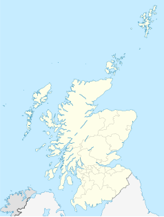
Położenie na mapie Szkocji | |||||||||||
Katedra św. Kolumby w Oban (ang. St Columba's Cathedral) – katedra rzymskokatolicka w Oban. Główna świątynia diecezji Argyll and the Isles. Mieści się przy Corran Brae.
Budowa świątyni rozpoczęła się w 1932, zakończyła się w 1959, konsekrowana w 1959. Zaprojektowana przez architekta Gilesa Gilberta Scotta. Reprezentuje styl neogotycki. Posiada wieżę.
Bibliografia
- Strona katedry. rcdai.org.uk. [zarchiwizowane z tego adresu (2014-09-03)].
Media użyte na tej stronie
(c) Karte: NordNordWest, Lizenz: Creative Commons by-sa-3.0 de
Location map of the United Kingdom
(c) Eric Gaba, NordNordWest, CC BY-SA 3.0
Location map of Scotland, United Kingdom
Blue Shield - the Distinctive emblem for the Protection of Cultural Property. The distinctive emblem is a protective symbol used during armed conflicts. Its use is restricted under international law.
Autor: Oryginalnym przesyłającym był Lofty z angielskiej Wikipedii, Licencja: Attribution
Photo taken by User:Lofty
Contains Ordnance Survey data © Crown copyright and database right, CC BY-SA 3.0
Blank map of Argyll and Bute, UK with the following information shown:
- Administrative borders
- Coastline, lakes and rivers
- Roads and railways
- Urban areas
Equirectangular map projection on WGS 84 datum, with N/S stretched 175%
Geographic limits:
- West: 7.2W
- East: 4.5W
- North: 56.8N
- South: 55.2N


