Katedra Matki Bożej Dobrej Pomocy w Motherwell
| katedra | |||||||||
(c) Anne Burgess, CC BY-SA 2.0 | |||||||||
| Państwo | |||||||||
|---|---|---|---|---|---|---|---|---|---|
| Kraj | |||||||||
| Miejscowość | |||||||||
| Wyznanie | |||||||||
| Kościół | |||||||||
| |||||||||
| |||||||||
Położenie na mapie North Lanarkshire Contains Ordnance Survey data © Crown copyright and database right, CC BY-SA 3.0 | |||||||||
Położenie na mapie Wielkiej Brytanii (c) Karte: NordNordWest, Lizenz: Creative Commons by-sa-3.0 de | |||||||||
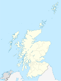
Położenie na mapie Szkocji | |||||||||
Katedra w Motherwell (ang. Cathedral Church of Our Lady of Good Aid) – katedra rzymskokatolicka w Motherwell. Główna świątynia diecezji Motherwell. Mieści się przy Coursington Road.
Budowa świątyni zakończyła się w 1900, konsekrowana w 1900. Reprezentuje styl neogotycki. Nie posiada wieży.
Bibliografia
Media użyte na tej stronie
Blue Shield - the Distinctive emblem for the Protection of Cultural Property. The distinctive emblem is a protective symbol used during armed conflicts. Its use is restricted under international law.
(c) Anne Burgess, CC BY-SA 2.0
More properly called the Cathedral of our Lady of Good Aid, this is the seat of the Roman Catholic Diocese of Motherwell. Originally an ordinary church, the striking red sandstone building was designed by Peter Paul Pugin and opened on 9 December 1900. It was renovated and adapted for use as a cathedral in 1948 by Jack Antonio Coia, and is a Category B Listed building.
(c) Eric Gaba, NordNordWest, CC BY-SA 3.0
Location map of Scotland, United Kingdom
Contains Ordnance Survey data © Crown copyright and database right, CC BY-SA 3.0
Blank map of North Lanarkshire, UK with the following information shown:
- Administrative borders
- Coastline, lakes and rivers
- Roads and railways
- Urban areas
Equirectangular map projection on WGS 84 datum, with N/S stretched 175%
Geographic limits:
- West: 4.21W
- East: 3.69W
- North: 56.07N
- South: 55.72N
(c) Karte: NordNordWest, Lizenz: Creative Commons by-sa-3.0 de
Location map of the United Kingdom


