Katedra w Manchesterze
| katedra | |||||||||
(c) Richard Rogerson, CC BY-SA 2.0 | |||||||||
| Państwo | |||||||||
|---|---|---|---|---|---|---|---|---|---|
| Kraj | |||||||||
| Miejscowość | |||||||||
| Wyznanie | |||||||||
| Kościół | |||||||||
| |||||||||
| |||||||||
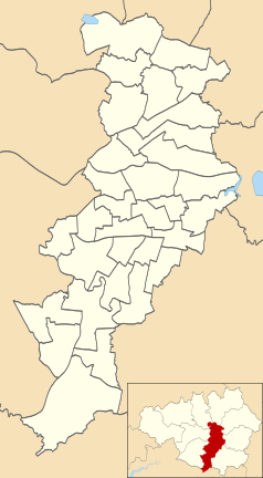
Położenie na mapie Manchesteru Contains Ordnance Survey data © Crown copyright and database right, CC BY-SA 3.0 | |||||||||
Położenie na mapie Wielkiej Brytanii (c) Karte: NordNordWest, Lizenz: Creative Commons by-sa-3.0 de | |||||||||
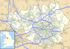
Położenie na mapie Wielkiego Manchesteru Contains Ordnance Survey data © Crown copyright and database right, CC BY-SA 3.0 | |||||||||
Katedra w Manchesterze (ang. Manchester Cathedral, formalnie Cathedral and Collegiate Church of St Mary, St Denys and St George) – kościół-matka anglikańskiej diecezji Manchesteru. Siedziba biskupa i miejski kościół parafialny.
Główny korpus katedry w dużej mierze powstał podczas urzędowania Jamesa Stanleya (naczelnika w latach 1485-1506) i reprezentuje styl Perpendicular Style. Stanley był przede wszystkim odpowiedzialny za wstawienie późnośredniowiecznych drewnianych mebli, m.in. lektorium, stalle w prezbiterium i dach nawy głównej, który jest podparty przez aniołów z pozłacanymi instrumentami. Średniowieczny kościół został gruntownie odnowiony, odrestaurowany i rozbudowany w epoce wiktoriańskiej, i ponownie po uszkodzeniu przez bombę w XX wieku. Katedra jest jednym z piętnastu budynków w Manchesterze, znajdujących się na liście zabytków Wielkiej Brytanii.
Bibliografia
- History of Manchester Cathedral. Timeline. manchestercathedral.org. [zarchiwizowane z tego adresu (2016-04-16)].
Media użyte na tej stronie
(c) Karte: NordNordWest, Lizenz: Creative Commons by-sa-3.0 de
Location map of the United Kingdom
Blue Shield - the Distinctive emblem for the Protection of Cultural Property. The distinctive emblem is a protective symbol used during armed conflicts. Its use is restricted under international law.
Flag of England. Saint George's cross (a red cross on a white background), used as the Flag of England, the Italian city of Genoa and various other places.
Contains Ordnance Survey data © Crown copyright and database right, CC BY-SA 3.0
Map of Manchester, Greater Manchester, UK with electoral wards shown.
Equirectangular map projection on WGS 84 datum, with N/S stretched 165%
Geographic limits:
- West: 2.33W
- East: 2.13W
- North: 53.55N
- South: 53.33N
Contains Ordnance Survey data © Crown copyright and database right, CC BY-SA 3.0
Map of Greater Manchester, UK with the following information shown:
- Administrative borders
- Coastline, lakes and rivers
- Roads and railways
- Urban areas
The data includes both primary routes and railway lines.
Equirectangular map projection on WGS 84 datum, with N/S stretched 165%
Geographic limits:
- West: 2.80W
- East: 1.90W
- North: 53.70N
- South: 53.32N
(c) Richard Rogerson, CC BY-SA 2.0
Manchester Cathedral Manchester Cathedral is located on Victoria Street in central Manchester. The cathedral's official name is The Cathedral and Collegiate Church of St Mary, St Denys and St George in Manchester. The current building began in 1215. with extensive rebuilding and refacing during the 1800s. http://www.manchestercathedral.org/content/view/36/41/


