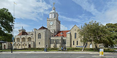
Katedra w Portsmouth
| katedra | |||||||||
 widok ogólny | |||||||||
| Państwo | |||||||||
|---|---|---|---|---|---|---|---|---|---|
| Kraj | |||||||||
| Miejscowość | |||||||||
| Wyznanie | |||||||||
| Kościół | |||||||||
| |||||||||
| |||||||||
Położenie na mapie Wielkiej Brytanii (c) Karte: NordNordWest, Lizenz: Creative Commons by-sa-3.0 de | |||||||||
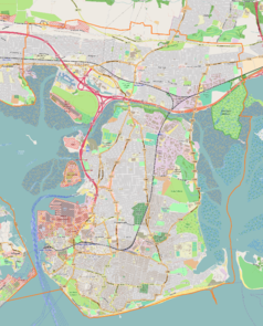
Położenie na mapie Hampshire Contains Ordnance Survey data © Crown copyright and database right, CC BY-SA 3.0 | |||||||||
Katedra w Portsmouth (ang. Portsmouth Cathedral lub Cathedral Church of St Thomas of Canterbury) – katedra diecezji Portsmouth Kościoła Anglii.
Pierwotnie była to kaplica zakonu augustianów. Kościół parafialny od 1327 roku i katedra od 1927 roku. Kaplica ufundowana około 1180 roku przez Jeana de Grisors. Prezbiterium pochodzi zapewne z około 1180-1190, transepty z koło 1190-1220. Stara wieża katedralna i nawa główna zniszczona i zastąpiona przez nową nawę i zachodnią wieżę w latach 1683–1693. Latarnia z kopułą dodane w 1703 roku. Przebudowy i prace restauracyjne wykonane w XVIII i XIX wieku. Dobudowy wykonane w latach 1935–1939 przez Sir Charlesa Nicholsona i w latach 1990–1991 (przedłużenie od strony zachodniej) przez Michaela Drury'ego z Winchesteru.
Bibliografia
Media użyte na tej stronie
(c) Karte: NordNordWest, Lizenz: Creative Commons by-sa-3.0 de
Location map of the United Kingdom
Blue Shield - the Distinctive emblem for the Protection of Cultural Property. The distinctive emblem is a protective symbol used during armed conflicts. Its use is restricted under international law.
Flag of England. Saint George's cross (a red cross on a white background), used as the Flag of England, the Italian city of Genoa and various other places.
Contains Ordnance Survey data © Crown copyright and database right, CC BY-SA 3.0
Map of Hampshire, UK with the following information shown:
- Administrative borders
- Coastline, lakes and rivers
- Roads and railways
- Urban areas
Equirectangular map projection on WGS 84 datum, with N/S stretched 155%
Geographic limits:
- West: 2.01W
- East: 0.68W
- North: 51.41N
- South: 50.68N
Autor: Lewis Hulbert, Licencja: CC BY-SA 3.0
This is a photo of listed building number 1333198.


