Katrineholm
 Dworzec kolejowy w Katrineholm (2011) | |||
| |||
| Państwo | |||
|---|---|---|---|
| Region | |||
| Gmina | Katrineholm | ||
| Powierzchnia | 11,81[1] km² | ||
| Populacja (2018) • liczba ludności • gęstość | 24 303[1] 2058[1] os./km² | ||
| Nr kierunkowy | (+46) 150 | ||
| Kod pocztowy | 641 xx | ||
| Strona internetowa | |||
| Portal | |||
Katrineholm – miasto (tätort)[a] w Szwecji, w regionie administracyjnym (län) Södermanland. Ośrodek administracyjny (centralort) gminy Katrineholm. W latach 1917–1970 Katrineholm miał administracyjny status miasta.
W 2010 r. Katrineholm liczył 21 993 mieszkańców[2].
Geografia
Katrineholm jest położone w prowincji historycznej Södermanland, pomiędzy jeziorem Näsnaren od północnego zachodu a należącymi do systemu rzeki Nyköpingsån jeziorami Duveholmsjön i Djulösjön od strony południowej[3].
Gospodarka
W mieście rozwinął się przemysł metalowy, maszynowy, samochodowy oraz elektrotechniczny[4].
Historia
Historia Katrineholm związana jest z rozwojem kolejnictwa. W 1862 r. zbudowano linię kolejową Västra stambanan, łączącą Sztokholm z Göteborgiem, zaś 4 lata później dołączono do niej linię do Norrköping (wówczas część Östra stambanan; współcześnie Södra stambanan, Katrineholm/Järna – Malmö). Oddana do użytku stacja Katrineholm stała się punktem węzłowym. Nazwa stacji pochodzi od posiadłości Catrineholm, położonej niedaleko jeziora Näsnaren[5].
Katrineholm rozwinęło się jako osada kolejowa. W 1883 r. miejscowość uzyskała status municipalsamhälle. Powstały pierwsze zakłady przemysłowe. W dniu 1 stycznia 1917 r. liczącemu 6615 mieszkańców Katrineholm nadano status miasta. W 1971 r., w wyniku reformy administracyjnej, gmina miejska Katrineholm (Katrineholms stad) weszło w skład nowo utworzonej gminy Katrineholm (Katrineholms kommun)[6].
Transport i komunikacja
Katrineholm jest ważnym węzłem komunikacyjnym, zarówno kolejowym i drogowym. Krzyżują się tam drogi krajowe nr 52 (Riksväg 52; Kumla – Nyköping), 55 (Riksväg 55; Uppsala – Norrköping), 56 (Riksväg 56; Norrköping – Gävle) i nr 57 (Riksväg 57; Järna – Katrineholm).
Na stacji węzłowej Katrineholm łączą się linie kolejowe Västra stambanan i Södra stambanan.
Osoby
W mieście urodziła się pisarka Carin Gerhardsen.
Galeria
Uwagi
- ↑ Według definicji Statistiska centralbyrån (SCB).
Przypisy
- ↑ a b c Statistiska tätorter 2018; befolkning, landareal, befolkningstäthet (szw.). Statistikmyndigheten SCB, 2020-03-20. [dostęp 2020-09-08]. [zarchiwizowane z tego adresu (2020-03-24)].
- ↑ Statistiska centralbyrån: Befolkning och arealer (szw.). [dostęp 2015-08-15].
- ↑ Myndigheten för samhällsskydd och beredskap: Översiktlig översvämningskartering längs Nyköpingsån (szw.). msb.se, 2002-11-29. [dostęp 2014-10-05].
- ↑ Katrineholm, [w:] Encyklopedia PWN [online] [dostęp 2021-07-15].
- ↑ Katrineholms kommun: Järnvägen (szw.). [dostęp 2015-08-15]. [zarchiwizowane z tego adresu (2016-01-08)].
- ↑ Katrineholms kommun: Historik om Katrineholm (szw.). [dostęp 2015-08-15]. [zarchiwizowane z tego adresu (2015-10-05)].
Media użyte na tej stronie
(c) Lokal_Profil, CC BY-SA 2.5
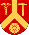
This coat of arms was drawn based on its blazon which – being a written description – is free from copyright. Any illustration conforming with the blazon of the arms is considered to be heraldically correct. Thus several different artistic interpretations of the same coat of arms can exist. The design officially used by the armiger is likely protected by copyright, in which case it cannot be used here.
Individual representations of a coat of arms, drawn from a blazon, may have a copyright belonging to the artist, but are not necessarily derivative works.
Autor: TS Eriksson, Licencja: CC BY 3.0
Katrineholm railway station
Autor: Erik Frohne, Licencja: CC BY 3.0
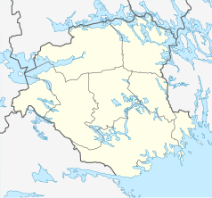
Location map of Södermanland county in Sweden
Equirectangular projection, N/S stretching 195 %. Geographic limits of the map:
- N: 59.60° N
- S: 58.50° N
- W: 15.50° E
- E: 17.80° E
Autor: Boberger. Photo: Bengt Oberger, Licencja: CC BY-SA 3.0
Part of Uta Jacobs´ sculptural work Bäcken rinne åter längs Köpmangatan in Katrineholm, Sweden


