Kemal-Eherek
 | |
| Państwo | |
|---|---|
| Położenie | okręg Jałta↗, Republika Autonomiczna Krymu |
| Pasmo | |
Położenie na mapie Krymu .jpg "Mapa lokalizacyjna Krymu") | |
| 44°34′44″N 34°11′04″E/44,578889 34,184444 | |
Kemal-Eherek (ukr. Кемаль-Егерек, krm. Kemal Egerek) – trzeci co do wysokości szczyt Gór Krymskich. Jego wysokość wynosi 1529 m n.p.m.
Znajduje się w odległości 6 km od centrum Massandry.
Linki zewnętrzne
Media użyte na tej stronie


U+25B2.svg
Black up-pointing triangle ▲, U+25B2 from Unicode-Block Geometric Shapes (25A0–25FF)
Black up-pointing triangle ▲, U+25B2 from Unicode-Block Geometric Shapes (25A0–25FF)
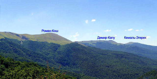
Kemal-Egerek2.jpg
Autor: Mevo (Павел Можаев), Licencja: CC BY-SA 3.0
The tip of the mount Kemal-Egerek in Crimea.
Autor: Mevo (Павел Можаев), Licencja: CC BY-SA 3.0
The tip of the mount Kemal-Egerek in Crimea.
Relief map of Crimea (disputed status).jpg
Physical map of the Crimea
Conformal projection, standard parallels — 45°15's.W.
Template parameters (coordinates of the edges):
Physical map of the Crimea
Conformal projection, standard parallels — 45°15's.W.
Template parameters (coordinates of the edges):