Kendari
| Ten artykuł od 2014-04 wymaga zweryfikowania podanych informacji. |
| |||||
| Państwo | |||||
|---|---|---|---|---|---|
| Prowincja | |||||
| Powierzchnia | 295,89 km² | ||||
| Populacja (2005) • liczba ludności |
| ||||
| Strona internetowa | |||||
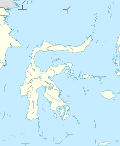
Kendari – miasto w Indonezji na wyspie Celebes nad morzem Banda; ośrodek administracyjny prowincji Celebes Południowo-Wschodni; powierzchnia 295,89 km²; 235 tys. mieszkańców (2005).
Ośrodek drobnego przemysłu i rzemiosła ludowego (gł. wyroby z miejscowych gatunków drewna). W mieście znajduje się uniwersytet (Universitas Halu Oleo, zał. 1981)[1][2].
W czasie II wojny światowej ważna baza morska i lotnicza, zajęta przez Japończyków 24 stycznia 1942 r.
Przypisy
- ↑ Universitas Halu Oleo. PDDikti: Pangkalan Data Pendidikan Tinggi. [zarchiwizowane z tego adresu (2020-10-14)]. (indonez.).
- ↑ Universitas Halu Oleo. SRV4 PDDIKT: Pangkalan Data Pendidikan Tinggi. [dostęp 2021-02-11]. [zarchiwizowane z tego adresu (2017-01-19)]. (indonez.).
Linki zewnętrzne
Media użyte na tej stronie
Autor: Uwe Dedering, Licencja: CC BY-SA 3.0
Location map of Indonesia.
Equirectangular projection. Stretched by 100.0%. Geographic limits of the map:
- N: 6.5° N
- S: -11.5° N
- W: 94.5° E
- E: 141.5° E
bendera Indonesia
Autor: Kendari City, Licencja: CC BY-SA 4.0
Flag of Kendari City, based on this image
Coat of Arms (Lambang) of City (Kota) Kendari, Provinsi Sulawesi Tenggara (South East Sulawesi Province), Indonesia
Perisai Lima (shield of five) is the emblem of Southeast Sulawesi Province of Indonesia. Depicting the image of Anoa head, chains, and ears of rice and cottons. Anoa is an endemic animal of Sulawesi, especially Southeast Sulawesi, the connecting chain symbolize strength of unity, ears of rice and cotton symbolize welfare and wealth for people.
Autor: NordNordWest, Licencja: CC BY-SA 3.0 de
Location map of Sulawesi, Indonesia


