Kentville
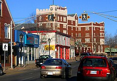
 Kentville – centrum miasta | |
| Państwo | |
|---|---|
| Prowincja | |
| Prawa miejskie | 1886 |
| Powierzchnia | 17,26 km² |
| Populacja (2016) • liczba ludności • gęstość |
|
| Strona internetowa | |
| Portal | |
Kentville (do 1826 Horton Corner) – miasto (town) w kanadyjskiej prowincji Nowa Szkocja, ośrodek hrabstwa Kings, podjednostka podziału statystycznego (census subdivision), położona w żyznej dolinie Annapolis Valley, nad rzeką Cornwallis River[1]. Według spisu powszechnego z 2016 obszar miasta to: 17,26 km², a zamieszkiwało wówczas ten obszar 6271 osób, cały obszar miejski (population centre) – 12 088 osób, natomiast aglomerację (census agglomeration) – 26 222 osoby[2].
Miejscowość, która pierwotnie była osadą ludności francuskojęzycznej (Akadyjczycy), do 1826 nosiła miano Horton Corner (od nazwy skrzyżowania na głównej ulicy), by w tym roku decyzją mieszkańców przyjąć (na cześć Edwarda, księcia Kentu przejeżdżającego przez ten rejon w 1794) nazwę używaną współcześnie, w 1886 otrzymała status miasta (town), w 1911 ustanowiono tutaj federalną rolniczą stację badawcza, od 1933 odbywa się w maju (ustanowiony z okazji trzechsetlecia tamtejszej uprawy jabłoni) doroczny Apple Blossom Festival[3].
Według spisu powszechnego z 2011 obszar miasta zamieszkiwało 6094 mieszkańców[4].
Przypisy
- ↑ Kentville, Natural Resources Canada / Ressources naturelles Canada – nrcan.gc.ca [dostęp 2021-05-10]; Kentville, Town [Census subdivision], Nova Scotia and Nova Scotia [Province] – Census Profile, 2016 Census, Statistics Canada / Statistique Canada – statcan.gc.ca [dostęp 2021-05-10]; W.B. Hamilton, Kentville, [w:] W.B. Hamilton, Place Names of Atlantic Canada, Toronto–Buffalo–London: University of Toronto Press, 1996, s. 341–342.
- ↑ Kentville, Town [Census subdivision], Nova Scotia and Nova Scotia [Province] – Census Profile, 2016 Census, Statistics Canada / Statistique Canada – statcan.gc.ca [dostęp 2021-05-10]; Kentville [Population centre], Nova Scotia and Nova Scotia [Province] – Census Profile, 2016 Census, Statistics Canada / Statistique Canada – statcan.gc.ca [dostęp 2021-05-10]; Kentville [Census agglomeration], Nova Scotia and Nova Scotia [Province] – Census Profile, 2016 Census, Statistics Canada / Statistique Canada – statcan.gc.ca [dostęp 2021-05-10].
- ↑ W.B. Hamilton, Kentville, [w:] W.B. Hamilton, Place Names of Atlantic Canada, Toronto–Buffalo–London: University of Toronto Press, 1996, s. 341–342.
- ↑ Kentville, Town [Census subdivision], Nova Scotia and Nova Scotia [Province] – Census Profile, Statistics Canada / Statistique Canada – statcan.gc.ca [dostęp 2021-05-10].
Media użyte na tej stronie
Flag of Canada introduced in 1965, using Pantone colors. This design replaced the Canadian Red Ensign design.
Flag of Nova Scotia.
Autor: Hanhil (talk) 19:46, 23 September 2009 (UTC), Licencja: CC BY-SA 3.0
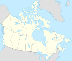
Location map of Nova Scotia, Canada
Autor: Yug, Licencja: CC-BY-SA-3.0
cropped version of Carte administrative du Canada.svg for map location.
The old Cornwallis Inn on Mainstreet, Kentville, NS, originally called the Aberdeen Hotel. It now contains private apartments, offices and retailers.


