Khardung La
| ||
 | ||
| Państwo | ||
| Wysokość | 5359 m n.p.m. | |
| Pasmo | Himalaje | |
| 34°16′42″N 77°36′15″E/34,278333 77,604167 | ||
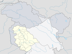
Khardung La – przełęcz w Himalajach o wysokości 5359 m. Leży w Indiach, w stanie Dżammu i Kaszmir, w regionie Ladakh. Do niedawna wysokość przełęczy podawano jako 5602 m, co czyniło by ją najwyższą przejezdną przełęczą na świecie. Najnowsze badania pokazały jednak, że rzeczywista wysokość Khardung La to 5359 m, a miano najwyższej przejezdnej przełęczy przypadło Semo La, której wysokość wynosi 5565 m.
Przełęcz ta znajduje się 37 km drogi od miasta Leh. Niższe partie drogi na przełęcz są pokryte asfaltem, ale wyższe partie są pokryte żwirem lub miejscami błotem powstałym na skutek topniejącego śniegu.
Linki zewnętrzne
Media użyte na tej stronie
Autor: Uwe Dedering, Licencja: CC BY-SA 3.0
Location map of India.
Equirectangular projection. Stretched by 106.0%. Geographic limits of the map:
- N: 37.5° N
- S: 5.0° N
- W: 67.0° E
- E: 99.0° E
The Flag of India. The colours are saffron, white and green. The navy blue wheel in the center of the flag has a diameter approximately the width of the white band and is called Ashoka's Dharma Chakra, with 24 spokes (after Ashoka, the Great). Each spoke depicts one hour of the day, portraying the prevalence of righteousness all 24 hours of it.
Autor:
- India_Jammu_and_Kashmir_location_map.svg: NordNordWest
- derivative work: Avoided blue (talk)
Location map of Jammu and Kashmir, India. De facto situation.
oriented mountain pass symbol : n ne e se


