Kings Highway (Australia)
| Długość | 151 km | ||||||||||||||||||||||||||||||||||||||||||||||||||||||||||||||||||||||||||||||||||||
|---|---|---|---|---|---|---|---|---|---|---|---|---|---|---|---|---|---|---|---|---|---|---|---|---|---|---|---|---|---|---|---|---|---|---|---|---|---|---|---|---|---|---|---|---|---|---|---|---|---|---|---|---|---|---|---|---|---|---|---|---|---|---|---|---|---|---|---|---|---|---|---|---|---|---|---|---|---|---|---|---|---|---|---|---|---|
| Stany i terytoria | Nowa Południowa Walia | ||||||||||||||||||||||||||||||||||||||||||||||||||||||||||||||||||||||||||||||||||||
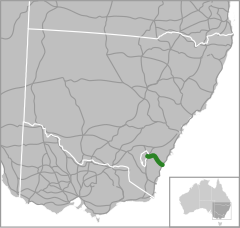
| Mapa | |||||||||||||||||||||||||||||||||||||||||||||||||||||||||||||||||||||||||||||||||||||
 | |||||||||||||||||||||||||||||||||||||||||||||||||||||||||||||||||||||||||||||||||||||
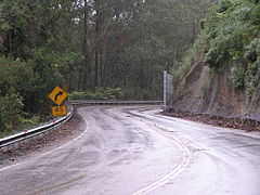
| Zdjęcie | |||||||||||||||||||||||||||||||||||||||||||||||||||||||||||||||||||||||||||||||||||||
 Podjazd na zboczu góry Clyde | |||||||||||||||||||||||||||||||||||||||||||||||||||||||||||||||||||||||||||||||||||||
| |||||||||||||||||||||||||||||||||||||||||||||||||||||||||||||||||||||||||||||||||||||
| Strona internetowa drogi | |||||||||||||||||||||||||||||||||||||||||||||||||||||||||||||||||||||||||||||||||||||
Kings Highway (oznaczana jako droga krajowa 52) - nazwa drogi w Nowej Południowej Walii w Australii, łączącej miasta Canberrę z Batemans Bay. Przebiega przez parki narodowe Clyde River i pograniczu parków Bimberamala z Monga W Batemans Bay, Kings Highway łączy się z drogą Princes Highway.
Media użyte na tej stronie
Sign no. 392 - Customs, darker version
prom rzeka-icon.
(Motorway) tunnel Icon. Drawing similar to Swiss road signs.
Gas station symbol
AIGA Air Transportation sign (inverted)
Warri Bridge on the Kings Highway (Canberra to Batemans Bay) crossing the Shoalhaven River near Braidwood, New South Wales, Australia.
Image of an Australian Route 1 shield.
Image of an Australian Route 52 shield.
Image of an Australian Route 23 shield.
Climbing the Clyde Mountain on the Kings Highway (Canberra to Batemans Bay), New South Wales, Australia.
Horse teams carting goods from the ship at Nellingen, New South Wales to Braidwood, New South Wales, crossing Currajong Creek, [1902?]
Location of Australia's Kings highway


