Kinross (Szkocja)
(c) Paul McIlroy, CC BY-SA 2.0 Centrum Kinross | |
| Państwo | |
|---|---|
| Kraj | |
| Hrabstwo | |
| Populacja (2011) • liczba ludności |
|
| Nr kierunkowy | 01577 |
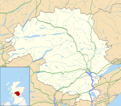
Położenie na mapie Perth and Kinross Contains Ordnance Survey data © Crown copyright and database right, CC BY-SA 3.0 | |
Położenie na mapie Wielkiej Brytanii (c) Karte: NordNordWest, Lizenz: Creative Commons by-sa-3.0 de | |
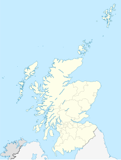
Położenie na mapie Szkocji | |
| Strona internetowa | |
| Portal | |
Kinross (gael. Ceann Rois) – miasto we wschodniej Szkocji, w hrabstwie Perth and Kinross (historycznie w Kinross-shire), położone nad jeziorem Loch Leven[2]. W 2011 roku liczyło 4891 mieszkańców[1].
Znajdują się tutaj XVII-wieczna rezydencja Kinross House oraz ruiny średniowiecznego zamku Lochleven, położonego na wyspie na jeziorze Loch Leven, gdzie w latach 1567–1568 więziona była Maria I Stuart, królowa Szkotów. Od XVIII wieku miasto jest ośrodkiem przemysłu włókienniczego (produkcja kaszmiru)[3][4].
Obok miasta przebiega autostrada M90[4].
Przypisy
- ↑ a b Area Profiles: Kinross. [w:] Census Data Explorer [on-line]. Scotland's Census. [dostęp 2018-08-13]. (ang.).
- ↑ Mapa OS Explorer 369, Ordnance Survey (ang.).
- ↑ Kinross, [w:] Encyclopædia Britannica [online] [dostęp 2018-08-13] (ang.).
- ↑ a b Kinross. Undiscovered Scotland. [dostęp 2018-08-13]. (ang.).
Media użyte na tej stronie
(c) Karte: NordNordWest, Lizenz: Creative Commons by-sa-3.0 de
Location map of the United Kingdom
(c) Paul McIlroy, CC BY-SA 2.0
Kinross High Street. Looking South, the clock tower is the old Town House which is no longer in use.
Contains Ordnance Survey data © Crown copyright and database right, CC BY-SA 3.0
Blank map of Perth and Kinross, UK with the following information shown:
- Administrative borders
- Coastline, lakes and rivers
- Roads and railways
- Urban areas
Equirectangular map projection on WGS 84 datum, with N/S stretched 180%
Geographic limits:
- West: 4.80W
- East: 2.95W
- North: 57.00N
- South: 56.10N
(c) Eric Gaba, NordNordWest, CC BY-SA 3.0
Location map of Scotland, United Kingdom


