Kiriłłow
 | |||||
| Państwo | |||||
|---|---|---|---|---|---|
| Obwód | |||||
| Rejon | kiryłłowski | ||||
| Populacja (2010) • liczba ludności |
| ||||
| Nr kierunkowy | (+7) 81757 | ||||
| Kod pocztowy | 161100 | ||||
| Strona internetowa | |||||
| Portal | |||||
Kiriłłow – miasto w Rosji w obwodzie wołogodzkim, między jeziorem Siwierskim i Dołgoje.
Liczba mieszkańców wynosi ok. 9 tys.
Przypisy
Media użyte na tej stronie
Autor: Uwe Dedering, Licencja: CC BY-SA 3.0
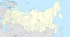
Location map of Russia.
EquiDistantConicProjection : Central parallel :
* N: 54.0° N
Central meridian :
* E: 100.0° E
Standard parallels:
* 1: 49.0° N
* 2: 59.0° N
Made with Natural Earth. Free vector and raster map data @ naturalearthdata.com.
Because the southern Kuril islands are claimed by Russia and Japan, they are shown as disputed. For more information about this see: en:Kuril Islands dispute. These islands are since 1945 under the jurisdiction of the Russian Federation.
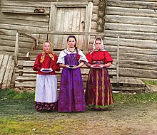
Young Russian peasant women in front of traditional wooden house, in a rural area along the Sheksna River near the small town of Kirillov. Early color photograph from Russia, created by Sergei Mikhailovich Prokudin-Gorskii as part of his work to document the Russian Empire from 1909 to 1915.
Позиционная карта Кирилловского района Вологодской области, 2009 год
Равноугольная проекция, растяжение — 200 %. Координаты краёв:
- север — 60.9° С
- юг — 59.4° С
- восток — 39.2° В
- запад — 37.6° В
Flag of Kirillov, Vologda oblast, Russia
Autor: Sergey Galchenkov (Сергей Галченков), Licencja: CC BY-SA 3.0
View of the Kirillo-Belozersky Monastery and the lake from one of the towers.
Позиционная карта Вологодской области
Равноугольная проекция. Координаты краёв:
- север — 62.0° С
- юг — 58.0° С
- запад — 34.0° В
- восток — 48.0° В


