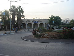
Kirjat Arba
 | |
| Państwo | |
|---|---|
| Dystrykt | |
| Powierzchnia | 4,4 km² |
| Populacja (2006) • liczba ludności • gęstość |
|
| Strona internetowa | |
| Portal | |
Kirjat Arba (hebr. קריית ארבע) – samorząd lokalny położony w Dystrykcie Judei i Samarii, w zachodniej części Judei w Izraelu. Miasteczko leży przy Hebronie, pomiędzy terytoriami Autonomii Palestyńskiej.
Historia
Osada została założona w 1968. Status samorządu lokalnego otrzymała w 1979.
Demografia
Zgodnie z danymi Izraelskiego Centrum Danych Statystycznych w 2006 roku w osadzie żyło 7 tys. mieszkańców[1].
Populacja osady pod względem wieku (dane z 2006):
| Wiek (w latach) | Procent populacji w % |
|---|---|
| 0-4 | 13,5% |
| 5-9 | 10,9% |
| 10-14 | 12,3% |
| 15-19 | 12,6% |
| 20-29 | 18,4% |
| 30-44 | 11,8% |
| 45-59 | 13,3% |
| ponad 60 | 7,2% |
Źródło danych: Central Bureau of Statistics.
Przypisy
- ↑ Israel Central Bureau of Statistics (ang.). [dostęp 2008-08-08].
Linki zewnętrzne
- Zdjęcie satelitarne Kirjat Arba Google Maps
- Mapa Kirjat Arba
Media użyte na tej stronie
Autor: NordNordWest, Licencja: CC BY-SA 3.0
Flag of Israel. Shows a Magen David (“Shield of David”) between two stripes. The Shield of David is a traditional Jewish symbol. The stripes symbolize a Jewish prayer shawl (tallit).
(c) Ramiy, CC-BY-SA-3.0
Israel: Judea and Samaria District according to official Israeli regulations. Unlike other administrative districts of Israel, this district is not entirely territorial - it includes only the Israeli settlements in the West Bank (excluding East Jerusalem which was annexed to Israeli Jerusalem district).


