Kohgiluje wa Bujerahmad
| ostan | |
 Krajobraz ostanu | |
| Państwo | |
|---|---|
| Siedziba | |
| Powierzchnia | 15 504,1 km²[1] |
| Populacja (2011) • liczba ludności |
|
| • gęstość | 42 os./km² |
Położenie na mapie Iranu | |
Kohgiluje wa Bujerahmad (per. استان کهگیلویه و بویراحمد) – ostan w południowo-zachodnim Iranie. Stolicą jest Jasudż.
Geografia
Ostan Kohgiluje wa Bujerahmad położony jest południowo-zachodniej części kraju w obrębie drugiego regionu administracyjnego[2]. Od północnego wschodu graniczy on z ostanami Czahar Mahal wa Bachtijari i Isfahan, od południowego wschodu z Farsem, od południowego zachodu z Buszehr, a od zachodu i północnego zachodu z Chuzestanem[3]. Zajmuje powierzchnię 15 504,1 km²[1] i większości leży w górach Zagros[3].
Klimatycznie Kohgiluje wa Bujerahmad dzieli się na dwa obszary. Obszar gorętszy, położony w południowej i zachodniej części ostanu ma klimat półpustynny. Wieją w nim ciepłe wiatry, a opady są w porównaniu z drugim obszarem raczej niskie i wahają się od 350 do 500 mm średniorocznie. Obszar chłodniejszy, położony w północnej i wschodniej części ostanu na wysokości 2100 m n.p.m., cechują obfite opady śniegu, temperatury spadające zimą do -10 °C i średnia roczna opadów w zakresie 600 do 800 mm[4].
Do większych miejscowości położonych na terenie ostanu należą: stołeczny Jasudż, Sisacht, Dehdaszt, Dogonbadan, Diszmok, Lande, Baszt, Margun, Dil i Sarab-e Tawe[3].
Demografia
Według spisu ludności z 2006 roku Kohgiluje wa Bujerahmad zamieszkiwało 634 299 osób. Spis ludności z 2011 roku podaje 658 629 mieszkańców, co stanowiło 0,88% populacji kraju. Wśród tych osób 329 079 stanowili mężczyźni, a 329 550 kobiety. 69,1% stanowi ludność w wieku 15-64 lat, 26,4% w wieku do lat 14, a 4,5% w wieku lat 65 i starsi[1].
Przypisy
- ↑ a b c Statistical Center of Iran: National Population and Housing Census 2011 (1390): Selected Findings (ang.). The President’s Office Deputy of Strategic Planning and Control. [dostęp 2014-10-23].
- ↑ همشهری آنلاین-استانهای کشور به ۵ منطقه تقسیم شدند (Provinces were divided into 5 regions). „Hamshahri Online”, 22-06-2014 (1 Tir 1393, Jalaali). ISSN 1735-6393 (pers.). [zarchiwizowane z adresu 23-06-2014].
- ↑ a b c Kohgilueh & Boyer ahmad Province. W: Google Maps [on-line]. [dostęp 2014-10-23].
- ↑ Kohgilueh & Boyer ahmad. Geography and History. ISTA Inc.. [dostęp 2014-10-23]. [zarchiwizowane z tego adresu (2013-04-11)].
Media użyte na tej stronie
Autor: Original work by Uwe Dering. Highlighted by Dr. Blofeld, Licencja: CC BY-SA 3.0
Locator map of Iran
Shadegan + Mountains
State emblem of the Islamic Republic of Iran. U+262B, stylized version of Arabic script of Allah (الله, with the central lam shaped to look like a sword.) The emblem is also an overlaid rendering of La Ilaha Illa Allah (There is only one God and that is 'Allah'). The exact shape of the emblem and an algorithmic ruler-and-compass construction is described in the national Iranian standard at IRANIAN ISLAMIC REPUBLIC FLAG, ISIRI 1, 1371, 3rd edition, March 1993 in Persian. The emblem was designed by Hamid Nadimi, and was officially approved by Ayatollah Khomeini on May 9, 1980.
Autor: Shadegan, Licencja: CC BY-SA 4.0
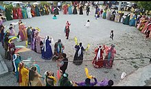
Handkerchief dance by Southern Lurs in Dehdasht


