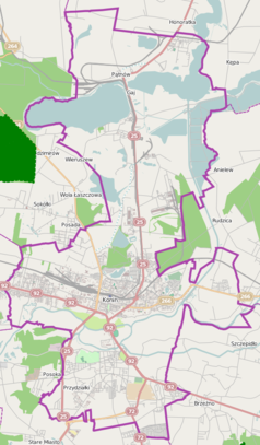
Konin Czarków
| ||
| Państwo | ||
| Województwo | ||
| Miejscowość | Konin | |
| Lokalizacja | Zatorze/Niesłusz | |
| Data otwarcia | 1915 | |
| Dane techniczne | ||
| Liczba peronów | 0 | |
| Liczba krawędzi peronowych | 0 | |
| Kasy | ||
| Linie kolejowe | ||
Położenie na mapie Polski (c) Karte: NordNordWest, Lizenz: Creative Commons by-sa-3.0 de | ||
| Portal | ||
Konin Czarków – zlikwidowany wąskotorowy przystanek kolejowy w Koninie na wąskotorowej linii kolejowej Anastazewo – Konin Wąskotorowy, w województwie wielkopolskim, w Polsce.
Bibliografia
- Konin Czarków w Ogólnopolskiej Bazie Kolejowej – bazakolejowa.pl
| Konin Czarków | ||
| Linia Anastazewo – Konin Wąskotorowy (37 km) | ||
odległość: 3 km | odległość: 1 km | |
Media użyte na tej stronie
(c) Karte: NordNordWest, Lizenz: Creative Commons by-sa-3.0 de
Location map of Poland
Autor: SANtosito, Licencja: CC BY-SA 4.0
Location map of Greater Poland Voivodeship. Geographic limits of the map:
- N: 53.70 N
- S: 51.05 N
- W: 15.68 E
- E: 19.19 E
Straight line aqross (according to naming convention, name + modifier)
ex terminal station, track to the right
ex terminal stop, track to the left
ex flag stop track aqross off use
Autor:
Mapa Konina, Polska


