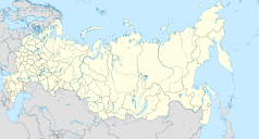
Konokowo
| |||
| Państwo | |||
|---|---|---|---|
| Kraj | |||
| Wysokość | 236 m n.p.m. | ||
| Populacja (2018) • liczba ludności | 7956 | ||
| Nr kierunkowy | +7 86140 | ||
| Kod pocztowy | 352464 | ||
| Portal | |||
Konokowo (ros. Коноково) – wieś (ros. село, trb. sieło) w Rosji, w Kraju Krasnodarskim, na lewym brzegu Kubania.
Według danych z 2002 miejscowość zamieszkują głównie Rosjanie (80,8%) i Ormianie (10,7%)[1].
Przypisy
- ↑ Успенский район (2002 г.), www.ethno-kavkaz.narod.ru [dostęp 2018-04-11].
Media użyte na tej stronie
Autor: Uwe Dedering, Licencja: CC BY-SA 3.0
Location map of Russia.
EquiDistantConicProjection : Central parallel :
* N: 54.0° N
Central meridian :
* E: 100.0° E
Standard parallels:
* 1: 49.0° N
* 2: 59.0° N
Made with Natural Earth. Free vector and raster map data @ naturalearthdata.com.
Because the southern Kuril islands are claimed by Russia and Japan, they are shown as disputed. For more information about this see: en:Kuril Islands dispute. These islands are since 1945 under the jurisdiction of the Russian Federation.
Autor: Stasyan117 (original)
Seryo93 (derivative), Licencja: CC BY-SA 2.0
Административная карта Краснодарского края, Россия.
- Координаты для GMT: -R36/42/43/47
- Инструменты: GMT, Inkscape
Flag of Konokovskoe rural settlement, Krasnodar Krai, Russia


