Konsulat RP w Pittsburghu
 | |
| Państwo | |
|---|---|
| Data utworzenia | 1920 |
| Data likwidacji | 1949 |
| Konsul Generalny | Heliodor Sztark |
| Zatrudnienie | 10 (1931) |
| Adres | |
| 249, N. Craig St. Pittsburgh | |
Konsulat RP w Pittsburghu (Consulate of the Republic of Poland in Pittsburgh) – polska placówka konsularna działająca w okresie między- i powojennym w Pittsburghu.
Urząd powołano w 1920 w Pittsburghu w randze Wicekonsulatu RP, któremu następnie podniesiono rangę do Konsulatu i który działał do 1945. W tymże 1945, reaktywowany jako Konsulat PRL, zaś po kilku latach działalności zamknięty.
Siedziba
Konsulat mieścił się przy 217 N. Craig St. (1920-1923), i 249 N. Craig St. (1923-1945)[1].
Konsulowie
- 1920-1926[2] – dr Kazimierz Kurnikowski, konsul/konsul gen. (1885-1965)
- 1926[1]-1932 – dr Artur Marian Ocetkiewicz, konsul (1888-)
- 1932-1933 – dr Jan Lech Byszewski, konsul (1893-1963)
- 1933-1935 – Jerzy Matusiński, konsul gen. (1890-1939)
- 1935-1938 – dr Karol Ripa, konsul gen. (1895-1983)
- 1938-1945 – Heliodor Sztark, konsul gen. (1886-1969)
- 1945-1947 – Roman Kwiecień, p.o. kier. konsulatu
- 1948-1949 – Zygmunt Fabisiak, konsul (1912-1981)
Zobacz też
- Ambasada RP w Waszyngtonie
- Konsulat Generalny RP w Chicago
- Konsulat Generalny RP w Houston
- Konsulat Generalny RP w Los Angeles
- Konsulat Generalny RP w Nowym Jorku
- b. Konsulat RP w Buffalo
- b. Konsulat RP w Detroit
- b. Konsulat RP w San Francisco
- b. Wicekonsulat RP w St. Louis
- Stałe Przedstawicielstwo RP przy ONZ w Nowym Jorku
Przypisy
- ↑ a b Paweł Ceranka, Krzysztof Szczepanik (opr.): Urzędy konsularne Rzeczypospolitej Polskiej 1918-1945 : informator archiwalny, Ministerstwo Spraw Zagranicznych/Naczelna Dyrekcja Archiwów Państwowych Warszawa 2020.
- ↑ Przemysław M. Żukowski: Pracownicy i absolwenci Uniwersytetu Jagiellońskiego w polskiej służbie zagranicznej, „Zeszyty Historyczne” (Paryż), 2008, z. 165, s. 54.
Bibliografia
- Register of the Dept. of State, Diplomatic Service Washington 1925
- Wojciech Skóra: Służba konsularna Drugiej Rzeczypospolitej. Organizacja, kadry i działalność, Wydawnictwo Adam Marszałek, Toruń 2006, 953 s., ISBN 83-7441-410-3.
- Stosunki dyplomatyczne Polski. Informator. Tom II Ameryka Północna i Południowa 1918-2007, Ministerstwo Spraw Zagranicznych, Archiwum/Wydawnictwo Askon Warszawa 2008, 224 s., ISBN 978-83-7452-026-3.
- Przemysław M. Żukowski: Pracownicy i absolwenci Uniwersytetu Jagiellońskiego w polskiej służbie zagranicznej, „Zeszyty Historyczne” (Paryż), 2008, z. 165, s. 34-70m, [w:] [1]
Media użyte na tej stronie
Autor: Uwe Dedering, Licencja: CC BY-SA 3.0
Location map of the USA (without Hawaii and Alaska).
EquiDistantConicProjection:
Central parallel:
* N: 37.0° N
Central meridian:
* E: 96.0° W
Standard parallels:
* 1: 32.0° N
* 2: 42.0° N
Made with Natural Earth. Free vector and raster map data @ naturalearthdata.com.
Formulas for x and y:
x = 50.0 + 124.03149777329222 * ((1.9694462586094064-({{{2}}}* pi / 180))
      * sin(0.6010514667026994 * ({{{3}}} + 96) * pi / 180))
y = 50.0 + 1.6155950752393982 * 124.03149777329222 * 0.02613325650382181
      - 1.6155950752393982  * 124.03149777329222 *
     (1.3236744353715044  - (1.9694462586094064-({{{2}}}* pi / 180))
      * cos(0.6010514667026994 * ({{{3}}} + 96) * pi / 180))
The flag of Navassa Island is simply the United States flag. It does not have a "local" flag or "unofficial" flag; it is an uninhabited island. The version with a profile view was based on Flags of the World and as a fictional design has no status warranting a place on any Wiki. It was made up by a random person with no connection to the island, it has never flown on the island, and it has never received any sort of recognition or validation by any authority. The person quoted on that page has no authority to bestow a flag, "unofficial" or otherwise, on the island.
Autor: unknown, Licencja:
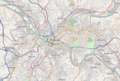
A map of the city of Pittsburgh and its surrounding areas
Coat of arms of the People's Republic of Poland
Autor: Alexrk2, Licencja: CC BY 3.0
Location map of Pennsylvania, USA


