Kopernik (krater marsjański)
 | |
| Ciało niebieskie | Mars |
|---|---|
| Średnica krateru | 294 km |
| Źródło nazwy | Mikołaj Kopernik |
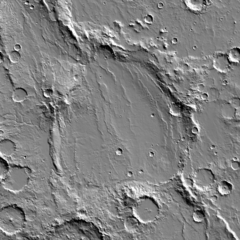
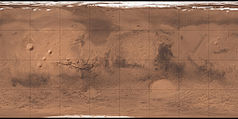
Kopernik (Copernicus) – krater na powierzchni Marsa o średnicy 294 km, położony na 48,8° szerokości południowej i 190,8° długości wschodniej (♂ 48,8°S 169,2°W/-48,800000 -169,200000).
Decyzją Międzynarodowej Unii Astronomicznej w 1973 roku został nazwany od polskiego astronoma Mikołaja Kopernika.
Zobacz też
Linki zewnętrzne
Media użyte na tej stronie
Carte de Mars reconstituée à partir des mesures de Mars Global Surveyor (MOLA) et des observations de Viking.
Crater Copernicus on Mars. A daytime infrared image mosaic from the Thermal Emission Imaging System (THEMIS) instrument of the 2001 Mars Odyssey spacecraft. Width of the image is 500 km.
Shiny LightSteelBlue button/marker widget. Used to mark the location of something such as a tourist attraction.


