Kozy Pomorskie
| ||
 Budynek dworcowy w 2019 | ||
| Państwo | ||
| Województwo | ||
| Miejscowość | Kozy | |
| Data otwarcia | 1895 | |
| Poprzednie nazwy | Kashagen | |
| Dane techniczne | ||
| Liczba peronów | 0 | |
| Linie kolejowe | ||
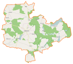
Położenie na mapie Polski (c) Karte: NordNordWest, Lizenz: Creative Commons by-sa-3.0 de | ||
| Portal | ||
Kozy Pomorskie – nieczynna stacja stargardzkiej kolei wąskotorowej w Kozach, w województwie zachodniopomorskim, w Polsce.
Zobacz też
Linki zewnętrzne
- Kozy Pomorskie w Ogólnopolskiej Bazie Kolejowej – bazakolejowa.pl
| Kozy Pomorskie | ||
| Linia Kozy Pomorskie – Poźrzadło Dwór (0 km) | ||
odległość: 2,88 km | ||
| Linia Stara Dąbrowa – Drawsko Pomorskie Wąskotorowe (24,28 km) | ||
odległość: 2,05 km | odległość: 2,57 km | |
Media użyte na tej stronie
Poland adm location map.svg
(c) Karte: NordNordWest, Lizenz: Creative Commons by-sa-3.0 de
Location map of Poland
(c) Karte: NordNordWest, Lizenz: Creative Commons by-sa-3.0 de
Location map of Poland
West Pomeranian Voivodeship location map.svg
Autor: SANtosito, Licencja: CC BY-SA 4.0
Location map of West Pomeranian Voivodeship. Geographic limits of the map:
Autor: SANtosito, Licencja: CC BY-SA 4.0
Location map of West Pomeranian Voivodeship. Geographic limits of the map:
- N: 54.65 N
- S: 52.58 N
- W: 13.95 E
- E: 17.10 E
Powiat stargardzki location map.png
Autor:
Mapa powiatu stargardzkiego, Polska
Autor:
OpenStreetMap contributors
,
Licencja: CC BY-SA 2.0
Mapa powiatu stargardzkiego, Polska
BSicon exKBHFr.svg
ex terminal station, track to the right
ex terminal station, track to the right
BSicon exKHSTl.svg
ex terminal stop, track to the left
ex terminal stop, track to the left
BSicon exKBHFl.svg
ex terminal station, track to the left
ex terminal station, track to the left
Dobrzany (gmina) location map.png
Autor:
Mapa gminy Dobrzany, Polska
Autor:
OpenStreetMap contributors
,
Licencja: CC BY-SA 2.0
Mapa gminy Dobrzany, Polska
Kozy Pomorskie railway station (1).jpg
Autor: MOs810, Licencja: CC BY-SA 4.0
Dworzec kolei wąskotorowej Kozy Pomorskie. 2019 r.
Autor: MOs810, Licencja: CC BY-SA 4.0
Dworzec kolei wąskotorowej Kozy Pomorskie. 2019 r.
BSicon exBHFq.svg
ex station ex track aqross
ex station ex track aqross
BSicon exKHSTr.svg
ex terminal stop, track to the right
ex terminal stop, track to the right
BSicon exSTRq.svg
Straight line aqross (according to naming convention, name + modifier)
Straight line aqross (according to naming convention, name + modifier)


