Krimpen aan den IJssel
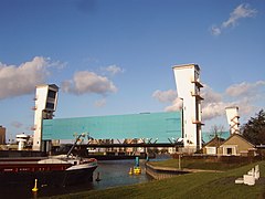
 Most zwodzony i śluza przeciwpowodziowa na rzece Hollandse IJssel, pomiędzy Krimpen aan den IJssel a Capelle aan den IJssel | |||||
| |||||
| Państwo | |||||
|---|---|---|---|---|---|
| Prowincja | |||||
| Burmistrz | Lennie Huizer (2014)[1] | ||||
| Powierzchnia | 7,79 km² | ||||
| Populacja • liczba ludności |
| ||||
| Kod pocztowy | 2921–2926 | ||||
| Strona internetowa | |||||
Krimpen aan den IJssel – miasto i gmina w Holandii, w prowincji Holandia Południowa. Miasto położone jest w zespole miejskim Rotterdamu, przy ujściu rzeki Hollandse IJssel do Nowej Mozy. Jego liczba ludności wynosi 28 855.
Przypisy
- ↑ krimpenaandenijssel.nl: L.M. Huizer. [dostęp 2014-07-19]. [zarchiwizowane z tego adresu (2014-08-12)]. (niderl.).
- ↑ Alle 408 gemeenten in 2013. kpn.nl. [dostęp 2013-11-09]. (niderl.).
Media użyte na tej stronie
Coat of arms of the Dutch municipality of krimpen aan den ijssel.
Autor: MartinD, Licencja: CC BY-SA 3.0
This is a picture of a proposed Rijksmonument in The Netherlands from the period 1959-1965. Its number in the list of 89 proposed monuments is:
Coat of Arms of Krimpen aan den IJssel, South Holland, the Netherlands.
Autor: Erik Frohne, Licencja: CC BY-SA 3.0
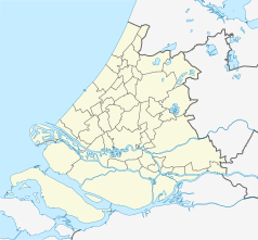
Location map of province South Holland in the Netherlands
Equirectangular projection, N/S stretching 162 %. Geographic limits of the map:
- N: 52.40° N
- S: 51.60° N
- W: 3.80° E
- E: 5.20° E


