Kuinre
 Panorama miejscowości | |||
| |||
| Państwo | |||
|---|---|---|---|
| Prowincja | |||
| Populacja (2006) • liczba ludności |
| ||
| Strona internetowa | |||
Kuinre (nds. De Kuunder) – miejscowość położona w północnej Holandii w prowincji Overijssel w gminie Steenwijkerland.
Dawniej nadmorska miejscowość portowa, o bogatej historii, wraz ze stopniowym osuszaniem Zuiderzee utraciłla znaczenie.
Media użyte na tej stronie
Autor: Erik Frohne, Licencja: CC BY-SA 3.0
Location map of province Overijssel in the Netherlands
Equirectangular projection, N/S stretching 164 %. Geographic limits of the map:
- N: 52.90° N
- S: 52.00° N
- W: 5.70° E
- E: 7.10° E
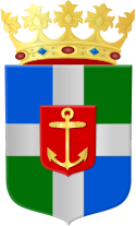
Coat of arms of the former Dutch municipality of Kuinre
Coat of arms of the Dutch municipality of Steenwijkerland.
View on Kuinre, Netherlands


