Kumbakonam
| Państwo | |
|---|---|
| Stan | |
| Dystrykt | |
| Populacja (2001) • liczba ludności |
|
| Nr kierunkowy | 435 |
| Kod pocztowy | 612001 |
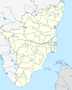
Położenie na mapie Indii | |
Kumbakonam – miasto w Indiach, w dystrykcie Thanjavur, położone nad rzeką Kaweri. W roku 2001 miasto liczyło 140 021 mieszkańców[1].
Miasto jest miejscem pielgrzymek wyznawców hinduizmu, którzy co 12 lat mogą wykąpać się w basenie Mahamakham napełnianym wodą z Gangesu. Wokół basenu wybudowanych jest 16 świątyń poświęconych Śiwie i Wisznu.
W mieście znajdują się ośrodki przemysłu włókienniczego i rzemiosła artystycznego. Funkcjonuje port rzeczny i lotniczy.
Przypisy
Media użyte na tej stronie
(c) Uwe Dedering z niemieckiej Wikipedii, CC BY-SA 3.0
Location map of India.
Equirectangular projection. Strechted by 106.0%. Geographic limits of the map:
- N: 37.5° N
- S: 5.0° N
- W: 67.0° E
- E: 99.0° E
The Flag of India. The colours are saffron, white and green. The navy blue wheel in the center of the flag has a diameter approximately the width of the white band and is called Ashoka's Dharma Chakra, with 24 spokes (after Ashoka, the Great). Each spoke depicts one hour of the day, portraying the prevalence of righteousness all 24 hours of it.
(c) Ravichandar84 z angielskiej Wikipedii, CC BY 3.0
Porter Town Hall, Kumbakonam (estd. 1883) and named after William Archer Porter, first principal of Government Arts College. The statue of the Hindu god Krishna at the entrance was set up in 1913 and is dedicated to the memory of R. Raghunatha Rao
Autor: Maximilian Dörrbecker (Chumwa), Licencja: CC BY-SA 3.0
Location map of Tamil Nadu


