Kungsängen
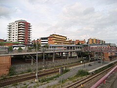
 Kungsängen (2010) | |
| Państwo | |
|---|---|
| Region | |
| Gmina | Upplands-Bro |
| Powierzchnia | 4,75[1] km² |
| Populacja (2018) • liczba ludności • gęstość | 12 014[1] 2531[1] os./km² |
| Nr kierunkowy | (+46) 08 |
| Kod pocztowy | 196 xx |
| Strona internetowa | |
| Portal | |
Kungsängen – miejscowość (tätort) w Szwecji, w regionie administracyjnym (län) Sztokholm. Siedziba władz (centralort) gminy Upplands-Bro.
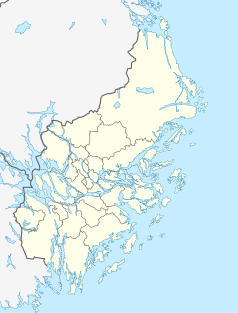
Miejscowość położona jest w prowincji historycznej (landskap) Uppland, ok. 30 km na północny zachód od centrum Sztokholmu nad jeziorem Melar. Kungsängen jest jedną ze stacji kolei podmiejskiej (linia J35 sztokholmskiego Pendeltågu). Na północny wschód od miejscowości przebiega trasa europejska E18.
W 2010 r. Kungsängen liczyło 9382 mieszkańców[2].
Przypisy
- ↑ a b c Statistiska tätorter 2018; befolkning, landareal, befolkningstäthet (szw.). Statistikmyndigheten SCB, 2020-03-20. [dostęp 2020-09-08]. [zarchiwizowane z tego adresu (2020-03-24)].
- ↑ Statistiska centralbyrån: Tätorter; arealer, befolkning. Tätorter 2010 (szw.). [dostęp 2014-07-16].
Media użyte na tej stronie
Autor: Erik Frohne, Licencja: CC BY 3.0
Location map of Stockholm County in Sweden
Equirectangular projection, N/S stretching 197 %. Geographic limits of the map:
- N: 60.30° N
- S: 58.70° N
- W: 17.10° E
- E: 19.50° E
Kungsängen station, Stockholm County
Autor: Lokal_Profil
, Licencja: CC BY-SA 2.5
This coat of arms was drawn based on its blazon which – being a written description – is free from copyright. Any illustration conforming with the blazon of the arms is considered to be heraldically correct. Thus several different artistic interpretations of the same coat of arms can exist. The design officially used by the armiger is likely protected by copyright, in which case it cannot be used here.
Individual representations of a coat of arms, drawn from a blazon, may have a copyright belonging to the artist, but are not necessarily derivative works.


