Kunratice (Praga)
| |||||
| |||||
 | |||||
| Państwo | |||||
| Miasto | Praga | ||||
| Data założenia | 1968 | ||||
| Powierzchnia | 8,10 km² | ||||
| Populacja (2007) • liczba ludności | 7 408 | ||||
| Kod pocztowy | 148 00 | ||||
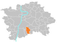
Położenie na mapie Pragi | |||||
| 50°00′48″N 14°29′08″E/50,013333 14,485556 | |||||
| Strona internetowa | |||||
| Portal | |||||
Kunratice – część Pragi leżąca w dzielnicy Praga 4, na południe od centrum miasta. W 2007 zamieszkiwało ją 7 408 mieszkańców.
Media użyte na tej stronie
Praha CoA CZ.svg
Prague coat of arms.
Prague coat of arms.
Prague CoA CZ.svg
Prague coat of arms.
Prague coat of arms.
Praha Kunratice stará škola.jpg
Autor: Czech Wikipedia user Packa, Licencja: CC BY-SA 2.5
Old school at Kunratice, Prague
Autor: Czech Wikipedia user Packa, Licencja: CC BY-SA 2.5
Old school at Kunratice, Prague
Municipal district Prague Kunratice.png
Location map of municipal district Prague-Kunratice
Location map of municipal district Prague-Kunratice


