Kurzętnik (stacja kolejowa)
| ||
 Budynek dawnej stacji kolejowej w Kurzętniku w 2017 r. | ||
| Państwo | ||
| Miejscowość | Kurzętnik | |
| Data otwarcia | 1 września 1902 | |
| Data zamknięcia | 3 kwietnia 2000 | |
| Poprzednie nazwy | Kauernik 1901-19, 1939-45 Kurzętnik 1920-39, od 1945 | |
| Dane techniczne | ||
| Liczba peronów | 2 | |
| Kasy | ||
| Linie kolejowe | ||
Położenie na mapie Polski (c) Karte: NordNordWest, Lizenz: Creative Commons by-sa-3.0 de | ||
| Portal | ||
Kurzętnik - zamknięta stacja kolejowa w Kurzętniku, w województwie warmińsko-mazurskim, w Polsce.
Bibliografia
- Informacje o stacji na stronie kolej.one.pl
- Kurzętnik w Atlasie Kolejowym Polski, Czech i Słowacji – www.atlaskolejowy.net
| Kurzętnik | ||
| Linia Tama Brodzka - Iława Główna (17,765 km) | ||
odległość: 5,537 km | odległość: 3,732 km | |
Media użyte na tej stronie
Poland adm location map.svg
(c) Karte: NordNordWest, Lizenz: Creative Commons by-sa-3.0 de
Location map of Poland
(c) Karte: NordNordWest, Lizenz: Creative Commons by-sa-3.0 de
Location map of Poland
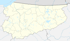
Warmian-Masurian Voivodeship location map.svg
Autor: SANtosito, Licencja: CC BY-SA 4.0
Location map of Warmian-Masurian Voivodeship. Geographic limits of the map:
Autor: SANtosito, Licencja: CC BY-SA 4.0
Location map of Warmian-Masurian Voivodeship. Geographic limits of the map:
- N: 54.52 N
- S: 53.07 N
- W: 19.05 E
- E: 22.95 E
BSicon KBHFl.svg
head station, track to the left
head station, track to the left
BSicon KBHFaq.svg
head station, track to the left
head station, track to the left
BSicon STRq.svg
Straight line aqross (according to naming convention, name + modifier)
Straight line aqross (according to naming convention, name + modifier)
BSicon BHFq.svg
station at track aqross
station at track aqross
BSicon KBHFr.svg
head station, track to the right
head station, track to the right
BSicon KBHFeq.svg
head station, track to the right
head station, track to the right
KURZĘTNIK 05 Stacja kolejowa.jpg
Autor: Andrzej Błaszczak, Licencja: CC BY-SA 4.0
Kurzętnik - stacja kolejowa
Autor: Andrzej Błaszczak, Licencja: CC BY-SA 4.0
Kurzętnik - stacja kolejowa
Nowe Miasto County location map02.svg
Autor: SANtosito, Licencja: CC BY-SA 4.0
Location map of Nowe Miasto County with urbanized area highlighted. Geographic limits of the map:
Autor: SANtosito, Licencja: CC BY-SA 4.0
Location map of Nowe Miasto County with urbanized area highlighted. Geographic limits of the map:
- N: 53.58 N
- S: 53.28 N
- W: 19.17 E
- E: 19.92 E


