Lövestad
 | |
| Państwo | |
|---|---|
| Region | |
| Gmina | |
| Powierzchnia | 1,07[1] km² |
| Populacja (2018) • liczba ludności • gęstość | |
| Nr kierunkowy | (+46) 417 |
| Kod pocztowy | 273 43 |
| Strona internetowa | |
| Portal | |
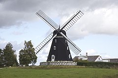
Lövestad – miejscowość (tätort) w południowej Szwecji, w regionie administracyjnym (län) Skania (gmina Sjöbo).
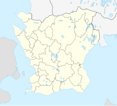
Miejscowość położona jest w południowo-wschodniej części prowincji historycznej (landskap) Skania, ok. 30 km na północ od Ystad.
Lövestad rozwinęło się w 2 połowie XIX wieku jako osada kolejowa przy oddanej do użytku w 1865/1866 linii Ystad – Eslöv (YEJ; Ystad – Eslövs Järnväg). W 1981 zamknięto dla ruchu pasażerskiego odcinek Eslöv – Tomelilla. W 1984 linia na odcinku Eslöv – Tomelilla została rozebrana[2].
W 1936 miejscowość otrzymała status municipalsamhälle w ramach gminy wiejskiej Lövestad (Lövestads landkommun). Od 1952 Lövestad był siedzibą władz gminy wiejskiej Östra Färs (Östra Färs landskommun), włączonej w 1974 do gminy Sjöbo[3].
W 2010 Lövestad liczył 643 mieszkańców[4].
Przypisy
- ↑ a b c Statistiska tätorter 2018; befolkning, landareal, befolkningstäthet (szw.). Statistikmyndigheten SCB, 2020-03-20. [dostęp 2020-09-08]. [zarchiwizowane z tego adresu (2020-03-24)].
- ↑ Rolf Sten: YEJ, Ystad-Eslövs Järnväg (szw.). [dostęp 2014-08-05].
- ↑ Lövestad.se: Lövestad – en ort med anor (szw.). [dostęp 2014-08-05]. [zarchiwizowane z tego adresu (2014-03-15)].
- ↑ Statistiska centralbyrån: Tätorter; arealer, befolkning. Tätorter 2010 (szw.). [dostęp 2014-08-05].
Media użyte na tej stronie
Autor: Erik Frohne, Licencja: CC BY 3.0
Location map of Scania (Skåne) in Sweden
Equirectangular projection, N/S stretching 179 %. Geographic limits of the map:
- N: 56° 37' N
- S: 55° 12' N
- W: 12° 12' E
- E: 15° 00' E
(c) Lokal_Profil, CC BY-SA 2.5
This coat of arms was drawn based on its blazon which – being a written description – is free from copyright. Any illustration conforming with the blazon of the arms is considered to be heraldically correct. Thus several different artistic interpretations of the same coat of arms can exist. The design officially used by the armiger is likely protected by copyright, in which case it cannot be used here.
Individual representations of a coat of arms, drawn from a blazon, may have a copyright belonging to the artist, but are not necessarily derivative works.


