Lütje Hörn

Lütje Hörn
Ilustracja
Lütje Hörn od południa
Kontynent

Europa

Państwo

 Niemcy

Kraj związkowy

 Dolna Saksonia

Akwen

Morze Północne

Powierzchnia

0,07 km²

Populacja 
• liczba ludności


0

Położenie na mapie Dolnej Saksonii
Mapa konturowa Dolnej Saksonii, blisko lewej krawiędzi u góry znajduje się punkt z opisem „Lütje Hörn”
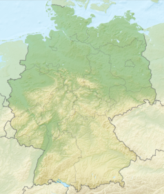
Położenie na mapie Niemiec
Mapa konturowa Niemiec, u góry po lewej znajduje się punkt z opisem „Lütje Hörn”
Ziemia53°35′26″N 6°51′50″E/53,590556 6,863889
Mapa wyspy

Lütje Hörn – niezamieszkana wyspa, wchodząca w skład wysp Wschodniofryzyjskich oraz jednocześnie obszar wolny administracyjnie (gemeindefreies Gebiet) w Niemczech w kraju związkowym Dolna Saksonia, w powiecie Leer. Powierzchnia jej wynosi 6,5 ha.

Bibliografia

  • Landesbetrieb für Statistik und Kommunikationstechnologie Niedersachsen, Hanower, 2009

Media użyte na tej stronie

Dark Green 004040 pog.svg
Autor: One Salient Oversight, Licencja: CC0
modded File:Blue pog.svg
Lütje Hörn in LER.svg
Deutsch (de): Lagekarte von Lütje Hörn, Landkreis Leer, Niedersachsen, Deutschland.
English (en): Locator map of Lütje Hörn in District of Leer, Lower Saxony, Germany.
français (fr): Plan de localisation de la municipalité Lütje Hörn dans l'arrondissement de Leer dans Basse-Saxe, Allemagne.
hornjoserbsce (hsb): Poziciska karta gmejny Lütje Hörn, Landkreis Leer, Niedersachsen, Němska.
македонски (mk): Положбена карта на Lütje Hörn во рамките на Landkreis Leer, Niedersachsen, Германија.
Nederlands (nl): Detailkaart van Lütje Hörn in de Landkreis Leer, Niedersachsen, Duitsland.
Esperanto (eo): Situomapo de Lütje Hörn en Landkreis Leer, Niedersachsen, Germanio.
മലയാളം (ml): ജർമ്മനിയിലെ Lower Saxony, District of Leer, Lütje Hörn ഭൂപടസ്ഥാനം.

Relief Map of Germany.png
Autor: derivative work Виктор_В, Licencja: CC BY-SA 3.0
Relief map of Germany
Lütje Hörn.jpg
Lütje Hörn im Jahr 2008 (im Hintergrund Memmert und die Westspitze von Juist)
DEU Landkreis Leer COA.svg
Wappen Landkreis Leer
Licentie
Lower Saxony relief location map.jpg
Autor: Grundkarte NordNordWest, Relief Alexrk2, Licencja: CC BY-SA 3.0
Physical Location map of Lower Saxony, Germany