La Ciotat
| miejscowość i gmina | |||
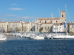
 Port i kościół w La Ciotat | |||
| |||
| Państwo | |||
|---|---|---|---|
| Region | |||
| Departament | |||
| Okręg | |||
| Kod INSEE | 13028 | ||
| Powierzchnia | 31,47 km² | ||
| Populacja (2008) • liczba ludności |
| ||
| • gęstość | 1021 os./km² | ||
| Kod pocztowy | 13600 | ||
| Strona internetowa | |||
| Portal | |||
La Ciotat – miejscowość i gmina we Francji, w regionie Prowansja-Alpy-Lazurowe Wybrzeże, w departamencie Delta Rodanu.
Według danych na rok 2008 gminę zamieszkiwało 34 271 osób, a gęstość zaludnienia wynosiła 973 osoby/km² (wśród 963 gmin regionu Prowansja-Alpy-W. Lazurowe La Ciotat plasuje się na 22. miejscu pod względem liczby ludności, natomiast pod względem powierzchni na miejscu 316.).
Miasta partnerskie
La Ciotat w filmie
W La Ciotat nakręcono jeden z najwcześniejszych filmów braci Lumière w historii kina, krótkometrażowy Wjazd pociągu na stację w La Ciotat.
Bibliografia
- Francuski urząd statystyczny. (fr.).
Media użyte na tej stronie
Autor: Superbenjamin, Licencja: CC BY-SA 4.0
Blank administrative map of France for geo-location purpose, with regions and departements distinguished. Approximate scale : 1:3,000,000
Autor: Flappiefh, Licencja: CC BY-SA 4.0
Blank administrative map of the region of Provence-Alpes-Côte d'Azur, France, for geo-location purpose.
Autor: Ludovic Ruat civodule, Licencja: CC-BY-SA-3.0
Port de La Ciotat, Bouches-du-Rhône, France. En arrière plan, l'Église Notre-Dame-de-l'Assomption ou Notre-Dame-du-Port.
Autor: Bourrichon (talk) - fr:Bourrichon, Licencja: CC BY-SA 3.0
Blank map of the department of Bouches-du-Rhône, France, for geo-location purpose, with distinct boundaries for regions, departments and arrondissements.
Autor: Diades, Licencja: CC BY-SA 3.0
The flag of Provence Alpes-Cote-d'Azur
Autor: Autor nie został podany w rozpoznawalny automatycznie sposób. Założono, że to DudeFromFrance (w oparciu o szablon praw autorskich)., Licencja: CC-BY-SA-3.0
France, Bouches-du-Rhones, La Ciotat. vue de La Ciotat avec l'Ile Verte, le Bec de l'Aigle, le Sémaphore, le chantier naval et la ville.
Photo prise en Aout 2006 depuis l'extrémité Ouest de la plage des Lecques (Saint-Cyr sur Mer, Var).


