La Garenne-Colombes
| miejscowość i gmina | |||
 | |||
| |||
| Państwo | |||
|---|---|---|---|
| Region | |||
| Departament | |||
| Okręg | |||
| Kod INSEE | 92035 | ||
| Mer | Philippe Juvin (od 2001) | ||
| Powierzchnia | 1,78 km² | ||
| Populacja (2012) • liczba ludności |
| ||
| • gęstość | 15 939 os./km² | ||
| Kod pocztowy | 92250 | ||
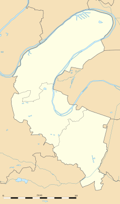
Położenie na mapie Hauts-de-Seine (c) Eric Gaba, Wikimedia Commons user Sting, CC BY-SA 3.0 | |||
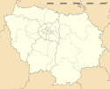
Położenie na mapie Île-de-France (c) Eric Gaba, Wikimedia Commons user Sting, CC BY-SA 3.0 | |||
| Portal | |||
Garenne-Colombes – miejscowość i gmina we Francji, w regionie Île-de-France, w departamencie Hauts-de-Seine.
Według danych na rok 2012 gminę zamieszkiwały 28 371 osoby, a gęstość zaludnienia wynosiła 15 939 osób/km² (wśród 1287 gmin regionu Île-de-France Garenne-Colombes plasuje się na 870. miejscu pod względem powierzchni.
Miasta partnerskie
Linki zewnętrzne
- Źródło danych: Francuski urząd statystyczny. (fr.).
Media użyte na tej stronie
Autor: Superbenjamin, Licencja: CC BY-SA 4.0
Blank administrative map of France for geo-location purpose, with regions and departements distinguished. Approximate scale : 1:3,000,000
(c) Eric Gaba, Wikimedia Commons user Sting, CC BY-SA 3.0
Blank administrative map of the region of Île-de-France, France, as in January 2015, for geo-location purpose, with distinct boundaries for regions, departments and arrondissements.
The flag of Navassa Island is simply the United States flag. It does not have a "local" flag or "unofficial" flag; it is an uninhabited island. The version with a profile view was based on Flags of the World and as a fictional design has no status warranting a place on any Wiki. It was made up by a random person with no connection to the island, it has never flown on the island, and it has never received any sort of recognition or validation by any authority. The person quoted on that page has no authority to bestow a flag, "unofficial" or otherwise, on the island.
Autor: Autor nie został podany w rozpoznawalny automatycznie sposób. Założono, że to Magicboost (w oparciu o szablon praw autorskich)., Licencja: CC BY 2.5
Autor: Patricia.fidi, Licencja: CC0
Unofficial (de facto) flag of the region Île-de-France in France. It was also the flag of the kingdom of France (s.XIV-XV)
(c) Eric Gaba, Wikimedia Commons user Sting, CC BY-SA 3.0
Blank administrative map of the department of the Hauts-de-Seine, France, as in January 2015, for geo-location purpose, with distinct boundaries for departments and arrondissements.
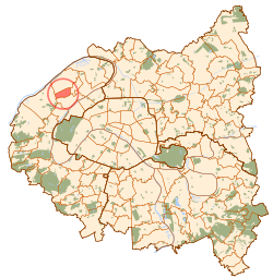
Map of Paris and its inner ring départements, localization of la Garenne-Colombes (Author: Metropolitan).


