La Villa de Los Santos
| |||||
 Kościół pw. Św. Anastazego w La Villa de Los Santos | |||||
| |||||
| Państwo | |||||
| Prowincja | |||||
| Data założenia | 1569 | ||||
| Powierzchnia | 10 km² | ||||
| Populacja • liczba ludności | 7 991 (2010)[1] | ||||
La Villa de Los Santos – miasto w południowej Panamie, położone na półwyspie Azuero nad brzegiem rzeki La Villa w prowincji Los Santos.
Liczba mieszkańców: 7 991 (2010). Stolica dystryktu Los Santos. Gospodarka miasta opiera się na rolnictwie i hodowli. W La Villa de Los Santos znajduje się także zabytkowy, XVI-wieczny barokowy kościół pw. Św. Anastazego.
Miasto jest znane z karnawału a także uroczystości procesyjnych w Boże Ciało i podczas Wielkiego Tygodnia.
Linki zewnętrzne
Przypisy
- ↑ Cuadro 12 Población en la República, por sexo, según Provincia, Comarca indígena, Distrito y Corregimiento: Censos de 2000 y 2010. Instituto Nacional de Estadística y Censo. Contraloría General de la República de Panamá.. [dostęp 2016-01-03].
Media użyte na tej stronie
Autor: Editorpana, Licencja: CC BY 3.0
This is a picture of the panamanian cultural heritage monument with the ID
Bandera de la provincia de Azuero, versión moderna utilizada por la Villa de Los Santos.
Autor: Rgarciacq, Licencja: CC BY-SA 4.0
Escudo de la villa de Los Santos, Panamá
Autor: Milenioscuro, Licencja: CC BY-SA 3.0
Location map of Los Santos province, Panama
Flag used in 1821 when the independence of La Villa de Los Santos from Spain was declared; made from the colors of the flag proposed by the Venezuelan general Francisco de Miranda in his personal diary "Colombeia" for his continental national project. In Los Santos, the design was taken from the flag hoisted for the first time in Vela de Coro, Venezuela in 1806, which had the colors reversed to those proposed by Miranda in his diary. This Flag was also used in the province of Azuero from 1850 to 1855. See C-No.144. Panamá, 17 de julio de 2003.
Autor: Alexrk, Licencja: CC BY-SA 3.0
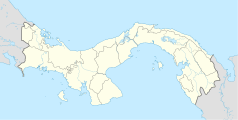
Location map of Panama
Equirectangular projection. Geographic limits of the map:
- N: 10.28° N
- S: 6.79° N
- W: 83.56° W
- O: 76.64° W


