Landerneau
| miejscowość i gmina | |||
 Pont de Rohan w Landerneau - jeden z ostatnich zamieszkanych mostów w Europie | |||
| |||
| Państwo | |||
|---|---|---|---|
| Region | |||
| Departament | |||
| Okręg | |||
| Kod INSEE | 29103 | ||
| Powierzchnia | 13,19 km² | ||
| Populacja (2013) • liczba ludności |
| ||
| Kod pocztowy | 29800 | ||
| Portal | |||
Landerneau (bret. Landerne) – miejscowość i gmina we Francji, w regionie Bretania, w departamencie Finistère. W 2013 roku populacja gminy wynosiła 16 081 mieszkańców[1]. W Landerneau uchodzi rzeki Élorn, która następnie płynie estuarium do zatoki Rade de Brest[2][3].
W grudniu 1949 roku w Landerneau Édouard Leclerc otworzył swój pierwszy sklep (przy rue Bélérit o powierzchni zaledwie 16 m², na terenie byłego klasztoru kapucynów), który zapoczątkował rozwój międzynarodowej sieci hipermarketów E.Leclerc. Od 2012 w tym miejscu mieści się sala wystawowa poświęcona sztuce współczesnej[4].
Współpraca
 Hünfeld, Niemcy
 Caernarfon, Walia
 Imadate, Japonia
 Mioveni, Rumunia
 Kongoussi, Burkina Faso
Przypisy
- ↑ Populations légales 2013 (fr.). INSEE. [dostęp 2016-11-26].
- ↑ Fiche cours d’eau – l’Élorn (J34-0300) (fr.). SANDRE. [dostęp 2016-11-26].
- ↑ Atlas Routier France 2014. Michelin, 2014, s. 75-76. ISBN 978-2-06-719261-4. (fr.)
- ↑ lejdd.fr: Michel-Edouard Leclerc, hyperactif à Landerneau (fr.). [dostęp 2019-01-06].
Media użyte na tej stronie
Autor: Superbenjamin, Licencja: CC BY-SA 4.0
Blank administrative map of France for geo-location purpose, with regions and departements distinguished. Approximate scale : 1:3,000,000
Autor: Eric Gaba (Sting - fr:Sting), Licencja: CC BY-SA 3.0
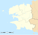
Blank administrative map of the region of Bretagne, France, for geo-location purpose, with distinct boundaries for regions, departments and arrondissements.
Autor: Eric Gaba (Sting - fr:Sting), Licencja: CC BY-SA 3.0
Blank administrative map of the department of Finistère, France, for geo-location purpose, with distinct boundaries for departments and arrondissements.
Autor: Tretinville, Licencja: CC BY-SA 3.0
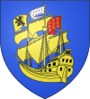
D'azur au trois-mâts-carré d'or équipé de même, ayant au pavillon du mât d'artimon les armes de Rohan, qui sont de gueules à neuf mâcles d'or, posées 3, 3, et 3; au pavillon du grand mât les armes de Bretagne, qui sont d'hermine; et au pavillon du mât de misaine, les armes de Léon, qui sont d'or au lion morné de sable.
Autor: Ghouston, Licencja: CC0
Pont de Rohan, the upstream side. Landerneau, Finistère, Bretagne, France


